
Current
Project Objectives
Conduct systematic line transect survey for marine mammals for density estimates; conduct survey to determine ecotype identity of killer whales; analyze existing and newly collected data for seasonal occurrence, abundance, and density of cetacean
Complete
Project Objectives
To determine the abundance and habitat use of California sea lions that haul out at Navy facilities and forage in testing and training areas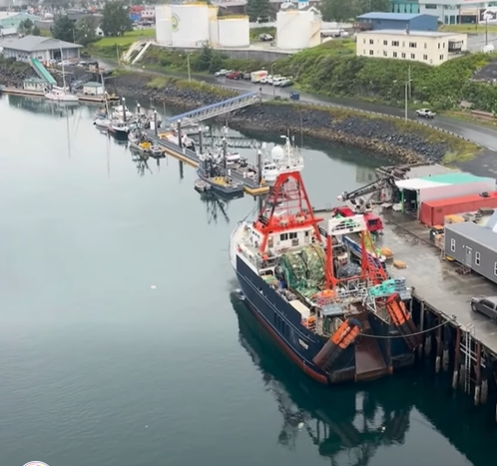
Killer Whale Ecotype Study (KWEST) kicks off
July 27, 2026
Research scientists from the University of Washington and NOAA recently departed from Kodiak, AK aboard the R/V Aquila for a 2-month research cruise focused on distinct groups of killer whales, or…
More details
Collapse details
Date Published:
Filesize:
- April 1, 2024
This report describes results from vessel surveys and visual species-verification trials conducted at the Jacksonville Shallow Water Training Range (JSWTR) in the Jacksonville Operating Area (OPAREA). This work continues from a multi-institutional monitoring program intended to provide information on the species composition, population identity, density, and baseline behavior of marine mammals and sea turtles present in United States (U.S.) Navy range complexes along the U.S. Atlantic Coast.
- 17,443.07 KB
More details
Collapse details
Date Published:
Filesize:
- May 1, 2024
During HDR Inc.’s 2022/23 field season, baleen whale sightings included humpback whales, North Atlantic right whales (Eubalaena glacialis), and fin whales (Balaenoptera physalus). This report will focus on results from the humpback whale sightings only
- 1,960.53 KB
More details
Collapse details
Date Published:
Filesize:
- June 1, 2022
Primary objectives of this project have included the following: Collect baseline occurrence data (location, sex, group size, behavior) of humpback whales (and other species of baleen whales, opportunistically), Obtain identification photographs of humpback whales for inclusion in regional and local catalogs, Collect biopsy samples of humpback whales for sex determination, mitochondrial control region sequencing and microsatellite genotyping of tissue samples, and stable isotope analysis to assess foraging related to prey consumption • Conduct satellite tagging to document seasonal humpback whale movement patterns in the nearshore waters off Virginia Beach, specifically whether the whales spend significant time in areas of high shipping traffic and/or areas of U.S. Navy training exercises
- 9,540.30 KB
More details
Collapse details
Date Published:
Filesize:
- June 1, 2025
During HDR Inc.’s 2023/24 field season, baleen whale sightings included humpback whales, NARWs, fin whales, minke whales (Balaenoptera acutorostrata), and sei whales (Balaenoptera borealis). This report will focus on the photo-ID results from all baleen whale sightings, photogrammetry results from the drone, and status of the MAHWC and Happywhale matching. See Aschettino et al. (2025) and Engelhaupt et al. (2025) for further information and details from the vessel survey and tagging efforts, and Ozog and Engelhaupt (2025) for details from the supporting aerial surveys.
- 6,218.53 KB
More details
Collapse details
Date Published:
Filesize:
- June 1, 2018
The objective of this multi-year project under the U.S. Navy’s Marine Species Monitoring Program has been to establish baseline information on occurrence and behavior of humpback whales near Naval Station Norfolk and within the Virginia Capes (VACAPES) Operating Area
- 6,005.42 KB
More details
Collapse details
Date Published:
Filesize:
- May 1, 2021
The objective of this multi-year project under the U.S. Navy’s Marine Species Monitoring Program has been to establish baseline information on occurrence and behavior of humpback whales near Naval Station Norfolk and within the Virginia Capes (VACAPES) Operating Area (OPAREA)
- 8,725.95 KB
More details
Collapse details
Date Published:
Filesize:
- June 29, 2015
This work builds upon and complements longer-term studies of movements and site fidelity of both Cuvier’s beaked whales (Ziphius cavirostris) and short-finned pilot whales (Globicephala macrorhynchus) off the North Carolina coast using photo-identiThe objective of this project under the U.S. Navy’s Marine Species Monitoring Program is to establish baseline occurrence and behavior data for humpback whales in the Hampton Roads mid-Atlantic region by addressing the following questions: • What age classes (juveniles, sub-adults, adults) are utilizing the waters within and adjacent to the mouth of the Chesapeake Bay? Do humpback whales exhibit site-fidelity over periods of days to years? Do humpback whales congregate in specific high-traffic and/or high-use U.S. Navy training areas? Do humpback whales spend significant time within or move through areas of U.S. Navy live-fire and MINEX training (Year 2)? What are the relative sound levels humpback whaication (photo-ID)
- 2,036.61 KB
More details
Collapse details
Date Published:
Filesize:
- August 1, 2017
The objective of this multi-year project under the U.S. Navy’s Marine Species Monitoring Program has been to establish baseline information on occurrence and behavior of humpback whales near Naval Station Norfolk and within the Virginia Capes (VACAPES) Operating Area by addressing the following questions: What age classes (juveniles, sub-adults, adults) are utilizing the waters within and adjacent to the mouth of the Chesapeake Bay? Do humpback whales exhibit site fidelity over periods of days to years? Do humpback whales congregate in specific high-traffic and/or high-use U.S. Navy training areas? Do humpback whales spend significant time within or move through areas of U.S. Navy live-fire and mine neutralization exercise (MINEX) training?
- 20,099.67 KB
More details
Collapse details
Date Published:
Filesize:
- July 1, 2019
The objective of this multi-year project under the U.S. Navy’s Marine Species Monitoring Program has been to establish baseline information on occurrence and behavior of humpback whales near Naval Station Norfolk and within the Virginia Capes (VACAPES) Operating Area by addressing the following questions: What age classes (juveniles, sub-adults, adults) are utilizing the waters within and adjacent to the mouth of the Chesapeake Bay? Do humpback whales exhibit site fidelity over periods of days to years? Do humpback whales congregate in specific high-traffic and/or high-use U.S. Navy training areas? Do humpback whales spend significant time within or move through areas of U.S. Navy live-fire and mine neutralization exercise (MINEX) training?
- 8,603.37 KB
More details
Collapse details
Date Published:
Filesize:
- May 1, 2020
The objective of this multi-year project under the U.S. Navy’s Marine Species Monitoring Program has been to establish baseline information on occurrence and behavior of humpback whales near Naval Station Norfolk and within the Virginia Capes (VACAPES) Operating Area by addressing the following questions: What age classes (juveniles, sub-adults, adults) are utilizing the waters within and adjacent to the mouth of the Chesapeake Bay? Do humpback whales exhibit site fidelity over periods of days to years? Do humpback whales congregate in specific high-traffic and/or high-use U.S. Navy training areas? Do humpback whales spend significant time within or move through areas of U.S. Navy live-fire and mine neutralization exercise (MINEX) training?
- 8,657.33 KB
Humpback whale affinity for shipping channels near the mouth of the Chesapeake Bay can prove fatal.
6th International Bio-logging Science Symposium .
More details
Collapse details
Date Published:
- September 25, 2017
- 5,778.32 KB
Humpback whale presence and habitat-use in high-traffic areas off Virginia.
21st Biennial Conference on the Biology of Marine Mammals .
More details
Collapse details
Date Published:
Filesize:
- December 13, 2015
The endangered North Atlantic humpback whale (Megaptera novaeangliae) migrates from six northern feeding grounds in the Gulf of Maine, the Gulf of St. Lawrence, Newfoundland/ Labrador, western Greenland, Iceland, and Norway to Caribbean Sea waters during the winter months (Katona and Beard 1990, Christensen et al. 1992, Palsbøll et al 1997). Understanding the occurrence and behavior of humpback whales in the vicinity of United States (U.S.) Navy training and vessel-transiting activities off the coast of Virginia is important in mitigating potentially harmful impacts on the species.
- 9,464.70 KB
More details
Collapse details
Date Published:
Filesize:
- July 7, 2026
A total of 22 nearshore and mid-shelf vessel surveys were completed during the 2024/25 field season. In total, 60 baleen whale sightings, including 40 sightings of humpback whales (Megaptera novaeangliae) totaling 59 individuals, 10 sightings of North Atlantic right whales (NARWs; Eubalaena glacialis) totaling 22 individuals, 7 sightings of fin whales (Balaenoptera physalus) totaling 14 individuals, and 3 sightings of individual minke whales (Balaenoptera acutorostrata), occurred during the 2024/25 field season. A total of 24 aerial surveys were flown during the 2024/25 field season in association with this effort and the Offshore Cetacean Study (OCS) (A. Engelhaupt et al. 2026); see Ozog and Engelhaupt 2026 for additional details regarding the aerial surveys. Baleen whale sightings from the aerial surveys included humpback (n=45), NARWs (n=8), fin (n=11), and minke (n=3) whales (Ozog and Engelhaupt 2026). During the OCS surveys, baleen whale sightings included fin whales (n=12), humpback whales (n=7), a blue whale (Balaenoptera musculus; n=1), a minke whale (n=1), and an NARW (n=1) (A. Engelhaupt et al. 2026). Across this project and the OCS effort, satellite-linked telemetry tags were deployed on one humpback whale, one fin whale, and one NARW. Customized Animal Tracking Solution tags were deployed on two NARWs and two humpback whales. One biopsy sample was collected from the satellite-tagged humpback whale.
- 9,528.24 KB
More details
Collapse details
Date Published:
Filesize:
- February 1, 2024
Since January 2015, HDR Inc. has been monitoring humpback whales (Megaptera novaeangliae) to assess their occurrence, habitat use, and behavior within and near United States (U.S.) Navy training and testing areas off Virginia via the Mid-Atlantic Humpback Whale Monitoring Project.
- 4,043.06 KB
More details
Collapse details
Date Published:
Filesize:
- July 1, 2023
Since January 2015, HDR Inc. has been monitoring humpback whales (Megaptera novaeangliae) to assess their occurrence, habitat use, and behavior within and near United States (U.S.) Navy training and testing areas off Virginia via the Mid-Atlantic Humpback Whale Monitoring Project.
- 8,609.08 KB
Incorporating telemetry information into capture-recapture analyses improves precision and accuracy of abundance estimates given spatiotemporally biased recapture effort.
Methods in Ecology and Evolution. 2024.
15:1847–1858.
More details
Collapse details
Date Published:
- February 13, 2024
- 2,529.56 KB
More details
Collapse details
Date Published:
Filesize:
- November 1, 2018
In August 2017, a marine mammal monitoring project was carried out combining boat-based field efforts and passive acoustic monitoring on and around the Pacific Missile Range Facility (PMRF). Commander, Pacific Fleet (PACFLT) funded five days of small-boat effort and the National Marine Fisheries Service funded an additional six days of effort. Information obtained was compared to previous sightings during small-boat effort by Cascadia Research Collective (CRC) off Kauai and Niihau, during 1,119 hr of effort (19,194 km) over nine different years from 2003 through 2016 (see Baird 2016)
- 2,093.16 KB
More details
Collapse details
Date Published:
Filesize:
- August 1, 2017
. This report summarizes information obtained through additional field efforts undertaken in 2016, while incorporating results from the first two years of effort. The present work is intended to complement ongoing research by Duke University off Cape Hatteras (hereinafter referred to as the Duke program) by providing information on the movement and diving behavior of these species over the medium term (weeks to months)
- 11,433.38 KB
More details
Collapse details
Date Published:
Filesize:
- March 1, 2018
This work builds upon and complements longer-term studies of movements and site fidelity of both Cuvier’s beaked whales (Ziphius cavirostris) and short-finned pilot whales (Globicephala macrorhynchus) off the North Carolina coast using photo-identification (photo-ID)
- 4,344.84 KB
More details
Collapse details
Date Published:
Filesize:
- June 1, 2019
This work builds upon and complements longer-term studies of movements and site fidelity of both Cuvier’s beaked whales (Ziphius cavirostris) and short-finned pilot whales (Globicephala macrorhynchus) off the North Carolina coast using photo-identification (photo-ID)
- 2,642.94 KB
More details
Collapse details
Date Published:
Filesize:
- May 1, 2024
As part of the long-term United States (U.S.) Navy-funded Marine Species Monitoring Program, from 11–19 February 2024, Cascadia Research Collective (CRC) carried out a vessel-based field effort in conjunction with passive acoustic monitoring undertaken by the U.S. Navy (Navy) scientists on and around the underwater hydrophone ranges of the Pacific Missile Range Facility (PMRF). The effort was timed to occur immediately prior to the start of a Submarine Command Course (SCC) to allow for collection of movement and dive data that could be used to examine exposure and response of cetaceans to Navy mid-frequency active sonar (MFAS; see Henderson et al. 2021). Eight days of field effort were funded by the Navy, and one day of field work was funded by National Oceanic and Atmospheric Administration (NOAA) Fisheries. Wildlife Computers SPLASH10-F satellite tags were funded by the Navy for deployment on Navypriority species, and additional tags were provided by Wildlife Computers or CRC for deployment on other species (e.g., humpback whales [Megaptera novaeangliae]). Tags were programmed to collect dive behavior and Fastloc®-Global Positioning System (GPS) data from the time deployed until three and a half days after the end of the SCC and continue to transmit the dive and Fastloc®-GPS data for an additional six days. Starting on either May 2nd or May 3rd, the tags were duty cycled to transmit only every second day, to provide longer-term tracks of individual movements. During the period that tags were collecting dive and Fastloc®-GPS data, tags were programmed to try to obtain Fastloc®-GPS locations only for the 12 hours of the day when there were no or limited satellite overpasses. This programming change from previous Kauaʻi field efforts was taken to minimize temporal gaps in location data during the period that overlapped with and immediately followed the SCC. Field efforts were undertaken out of Kikiaola small boat harbor when conditions allowed for working on or near PMRF, or out of Port Allen when conditions on or near PMRF were not workable.
- 4,707.83 KB
More details
Collapse details
Date Published:
Filesize:
- February 1, 2011
Movements and Spatial Use of Satellite‐tagged Odontocetes in the Western Main Hawaiian Islands: Results of Fieldwork Undertaken off O‘ahu in October 2010 and Kaua‘i in February 2011
- 1,236.87 KB
More details
Collapse details
Date Published:
Filesize:
- June 7, 2012
Although considerable information is available on residency patterns and spatial use of odontocetes in the eastern half of the Hawai‘i Range Complex (HRC), much less is known about odontocetes in the western half of the HRC. In the second year of a three-year effort in the western main Hawaiian Islands we undertook surveys off Kaua‘i and Ni‘ihau in July/August 2011, to examine spatial use and residency patterns using satellite tags, to provide visual verification of acoustically-detected odontocetes on the Pacific Missile Range Facility (PMRF), and to obtain individual identification photographs and biopsy samples for assessment of population identity and structure.
- 3,048.07 KB
More details
Collapse details
Date Published:
Filesize:
- August 27, 2012
As part of an assessment of habitat use and movements of odontocetes being undertaken in the western half of the main Hawaiian Islands (see Baird et al. 2011, 2012), field operations funded by Commander, U.S. Navy Pacific Fleet were undertaken off of Kaua‘i in January 2012. There were two primary goals of these operations: 1) providing species verification for acoustic detections by the Marine Mammal Monitoring on Navy Ranges (M3R) project on the Pacific Missile Range Facility (PMRF) hydrophone range (see Moretti et al. 2012); and 2) deploying satellite tags prior to a Submarine Commanders Course (SCC) training event to be undertaken off Kaua‘i in February 2012.
- 2,519.53 KB
More details
Collapse details
Date Published:
Filesize:
- November 8, 2013
Here we combine results of field efforts funded through the U.S. Navy’s Living Marine Resources Program (through a three-year grant from the Naval Postgraduate School) as well as additional field time in the study area in 2011 and 2012 funded through the Pacific Islands Fisheries Science Center and Commander, Pacific Fleet. We also utilize results from research efforts in the eastern main Hawaiian Islands, off Lāna‘i, Maui, and Hawai‘i Island, to help interpret results from photo-identification and satellite tagging.
- 2,159.00 KB
More details
Collapse details
Date Published:
Filesize:
- December 16, 2013
A joint project in February 2013 of the Pacific Missile Range Facility (PMRF) combined passive acoustic monitoring and boat-based field efforts. There were 1,010 kilometers (km) (55.9 hours [hr]) of small-vessel field effort over the course of the 8-day project. Of the 55.9 hr of survey effort, 64.2 percent was spent within the PMRF instrumented hydrophone range boundaries, and 14.8 percent of the effort was in depths greater than 1,000 meters (m).
- 2,028.91 KB
More details
Collapse details
Date Published:
Filesize:
- February 5, 2013
A joint project in July and August 2013 on and around the Pacific Missile Range Facility (PMRF) combined passive acoustic monitoring and boat-based field efforts. There were 671 kilometers (36.6 hours [hr]) of small-vessel survey effort over the course of the 8-day project, with 55.1 percent of time (20.2 hr) spent within the PMRF instrumented hydrophone range boundaries. A total of 33.0 hr of acoustic monitoring coincided with the small-vessel field effort.
- 2,118.63 KB
More details
Collapse details
Date Published:
Filesize:
- April 24, 2015
A joint project in February 2014 on and around the Pacific Missile Range Facility (PMRF) was carried out utilizing combined passive acoustic monitoring and boat-based field efforts. There were 1,287 kilometers (km) (66.3 hours [hr]) of small-vessel survey effort over the course of the 10 day project, with 44.6 percent of search time (29.6 hr) spent within the PMRF instrumented hydrophone range boundaries. A total of 81.7 hr of acoustic monitoring was undertaken during the field effort. There were 26 sightings of five species of odontocetes, six of which were directed by acoustic detections from the Marine Mammal Monitoring on Navy Ranges (M3R) system.
- 6,792.21 KB
More details
Collapse details
Date Published:
Filesize:
- May 2, 2016
A joint project in February 2015 on and around the Pacific Missile Range Facility (PMRF) was carried out utilizing combined boat-based field efforts and passive acoustic monitoring from the Marine Mammal Monitoring on Navy Ranges (M3R) system. There were 1,132 kilometers (63.4 hours [hr]) of small-vessel survey effort over the course of the 13-day project. Weather conditions precluded field operations on 4 days, and strong westerly winds and/or range operations limited access to PMRF on seven additional days, with only 15.1 percent of search time (9.6 hr) spent within the range boundaries.
- 2,992.69 KB
More details
Collapse details
Date Published:
Filesize:
- June 1, 2017
As part of a long-term U.S. Navy-funded marine mammal monitoring program, in February 2016 a combining boat-based field effort and passive acoustic monitoring was carried out on and around the Pacific Missile Range Facility (PMRF). The U.S. Navy funded five days of small-boat effort and the National Marine Fisheries Service funded an additional two days of effort. There were 859 kilometers (49 hours) of small-vessel survey effort over the course of the seven day project.
- 2,847.59 KB
More details
Collapse details
Date Published:
Filesize:
- July 24, 2018
As part of a long-term U.S. Navy-funded marine mammal monitoring program, in August 2017 a combination of boatbased field effort and passive acoustic monitoring was carried out on and around the Pacific Missile Range Facility (PMRF) off Kaua‘i prior to a Submarine Command Course scheduled for mid-August 2017. The U.S. Navy funded five days of small-boat effort and the National Marine Fisheries Service funded an additional six days of effort. There were 1,113 kilometers (77.4 hours) of small-vessel survey effort over the course of the 11 day project.
- 4,400.14 KB
More details
Collapse details
Date Published:
Filesize:
- June 7, 2019
As part of a long-term U.S. Navy-funded marine mammal monitoring program, in August 2018 a combination of vessel-based field effort and passive acoustic monitoring was carried out on and around the Pacific Missile Range Facility (PMRF) Kaua‘i prior to a Submarine Commander Course scheduled for mid-August 2018. The purpose of the monitoring effort was to assess the spatial movement patterns and habitat use of cetaceans that are exposed to mid-frequency active sonar and how those patterns influence exposure and potentially responses.
- 10,036.77 KB
More details
Collapse details
Date Published:
Filesize:
- February 1, 2021
As part of a long-term U.S. Navy-funded marine mammal monitoring program, in February 2020 a combination of vesselbased field effort and passive acoustic monitoring was carried out on and around the Pacific Missile Range Facility (PMRF) off Kaua‘i prior to a Submarine Command Course scheduled for mid-February 2020. The purpose of the monitoring effort was to assess the spatial movement patterns and habitat use of cetaceans that are exposed to midfrequency active sonar and how those patterns influence exposure and potentially responses. Results from this effort were compared with previous Cascadia Research Collective (CRC) survey effort and photo-identification and tag data from Kaua‘i, based on surveys in 11 different years since 2003.
- 4,010.56 KB
Unintended consequences of using dolphins to catch tuna: Examining the extent and nature of hook and line fishery interactions with pantropical spotted dolphins off the island of Hawai'i.
21st Biennial Conference on the Biology of Marine Mammals .
More details
Collapse details
Date Published:
Filesize:
- December 13, 2015
In Hawai'i fishermen use a variety of hook and line methods to catch tuna associated with pantropical spotted dolphins. In response to reports of dolphins being hooked in fisheries, the National Marine Fisheries Service (NMFS) proposed recategorizing two fisheries ("charter vessel" and "trolling, rod and reel") in 2011 from Category III (those having a remote likelihood of serious injury/mortality) to Category II (those having occasional serious injury/mortality). After reviewing comments received in response to the proposal, NMFS did not re-categorize the fisheries, in part because of statements that fishing effort around dolphins may have been overestimated and that many vessels just trolled near dolphins, not through groups. We used photo-identification of individually distinctive vessels fishing in association with dolphin groups and observations on the number and behavior of vessels with dolphins to examine the extent and nature of interactions between fishing vessels and spotted dolphins off Hawai'i Island. Since 2010, 34.5% of spotted dolphin encounters had fishing vessels present within the group envelope of the dolphins (mean=3.7, SD=3.5, range=1-19, n=57 of 165 encounters). Two primary fishing methods were used, either trolling through groups of dolphins or repeatedly transiting through a group at high speed to the advancing front of the group and stopping and fishing as the group passed by, with some vessels alternating methods during encounters. Since 2010, 133 different vessels were documented fishing in association with dolphins; of these, 38 (28.6%) were documented on two or more occasions, and 26 were documented in two or more years. A mark-recapture abundance estimate of the number of vessels fishing in association with spotted dolphins in 2012 and 2013 was 322 (CV=0.05). In 2015 NMFS recognized three distinct island-associated populations of spotted dolphins in Hawai'i, including one off Hawai'i Island, thus the population of dolphins involved in these interactions is smaller than originally expected. While many factors likely influence the probability of boats fishing associated with dolphin groups, continued reports of occasional hooking combined with the relatively large number of vessels "fishing" dolphins suggest the fisheries categories should be re-evaluated.
- 92.10 KB
Effects of Navy sonar on whales and dolphins in the Hawaiian Islands: some data, some speculation, some gaps..
Presentation to the Hawaiian Islands Humpback Whale National Marine Sanctuary Advisory Council (virtual event) .
More details
Collapse details
Date Published:
- September 15, 2020
- 5,898.74 KB
Odontocete cetaceans around the Main Hawaiian Islands: habitat use and relative abundance from small-boat sighting surveys.
Aquatic Mammals. 2013.
39(3):253-269
More details
Collapse details
Date Published:
- June 1, 2013
Fishery interactions for three populations of false killer whales in Hawai’i: Assessment using dorsal fin line injuries.
20th Biennial Conference on the Biology of Marine Mammals .
More details
Collapse details
Date Published:
- December 9, 2013
- 4,123.37 KB
Site fidelity, spatial use, and behavior of dwarf sperm whales in Hawaiian waters: using small-boat surveys, photo-identification, and unmanned aerial systems to study a difficult-to-study species.
Marine Mammal Science. 2021.
326-348
More details
Collapse details
Date Published:
Publication:Ocean:Region:Species:Methods:
- August 24, 2021
Dwarf sperm whales (Kogia sima) have been studied rarely at sea. We used photo-identification, boat- and drone-based behavioral observations, and citizen science photo contributions to examine site fidelity, spatial use, and behavior in Hawaiʻi. Sighting rates were highest in island slope (500–1,000 m) waters. Over 40% of photo-identified individuals were linked by association in the same social network. More than half of the very distinctive individuals were seen more than once, and 28.5% were seen in multiple years, with one individual seen 14 times over a 15-year span. Resighted individuals and those in the main cluster of the social network were found in significantly shallower water than individuals that were not resighted or that were in isolated clusters. Distances between resighting locations suggest small home ranges. This suggests an insular slope-dwelling population that overlaps with an offshore population. Evidence of unsuccessful predatory attempts by large sharks was recorded on four individuals, and linear wounds consistent with interactions with line fisheries were documented on three individuals. Surface and subsurface behavior recorded by drone revealed vigilance behavior likely to minimize predation risk. Lessons learned from this study can be applied elsewhere to increase knowledge of this poorly known and difficult-to-study species.
Long-term strategies for studying rare species: results and lessons from a multi-species study of odontocetes around the main Hawaiian Islands.
Pacific Conservation Biology. 2023.
30:PC23027
More details
Collapse details
Date Published:
- June 5, 2023
- 3,091.12 KB
More details
Collapse details
Date Published:
Filesize:
- January 1, 2015
The goals of this study were to determine abundance, habitat use, and distribution patterns of bottlenose dolphins in St. Andrew Bay and adjacent coastal waters in the NSWC PCD Testing Range over two seasons.
- 1,341.67 KB
More details
Collapse details
Date Published:
Filesize:
- January 1, 2016
The goal of the spring 2016 component of this project was to conduct photographicidentification (photo-id) surveys to determine seasonal (spring) abundance, habitat use, and distribution patterns of bottlenose dolphins in St. Andrew Bay (SAB) and adjacent coastal waters surrounding the Naval Surface Warfare Center, Panama City Division (NSWC PCD).
- 312.71 KB
More details
Collapse details
Date Published:
Filesize:
- September 1, 2016
The goal of the fall 2016 component of this project was to conduct photographic-identification (photo-id) surveys to determine seasonal (fall) abundance, habitat use, and distribution patterns of bottlenose dolphins in St. Andrew Bay and adjacent coastal waters surrounding the Naval Surface Warfare Center, Panama City Division (NSWC PCD).
- 606.33 KB
More details
Collapse details
Date Published:
Filesize:
- January 1, 2016
The goals of this study were to conduct photographic-identification (photo-ID) surveys during 2015 and 2016 to determine abundance, distribution patterns, habitat use, and site fidelity of bottlenose dolphins in St. Andrew Bay and adjacent coastal waters in the NSWC PCD Testing Range over four sampling periods (July and October 2015, and April and October 2016).
- 2,163.29 KB
Unique morphological and acoustic characteristics of beaked whales (Mesoplodon sp.) off the west coast of Baja California, Mexico.
Marine Mammal Science. 2021.
38:383–390
More details
Collapse details
Date Published:
Publication:Ocean:Region:Methods:
- July 1, 2021
Unique morphological and acoustic characteristics of beaked whales (Mesoplodon sp.) off the west coast of Baja California, Mexico
Mouthline injuries as an indicator of fisheries interactions for false killer whales and pygmy killer whales in Hawai'i.
21st Biennial Conference on the Biology of Marine Mammals .
More details
Collapse details
Date Published:
Filesize:
- December 13, 2015
Evidence from strandings and anecdotal reports indicate that a number of odontocete species interact with near-shore fisheries in Hawai'i. In the absence of observer programs in these fisheries, we evaluated mouthline injuries from known resident populations of false killer whales and pygmy killer whales, to assess the viability of this method to document injuries associated with hook and line fishery interactions. All individuals with mouthlines visible were selected from photo-ID catalogs and scored for presence of mouthline injuries consistent with fisheries interactions. Ninety-seven false killer whales and 47 pygmy killer whales had ≥50% of the mouthline visible using fair to excellent quality photos, with a mean of 67% and 59% mouthline visible, respectively. Preliminary analysis suggests that main Hawaiian Islands insular false killer whales have high rates of mouthline injuries- 20% of adult and sub-adult individuals with ≥50% mouthline visible have injuries consistent with fisheries interactions, supporting studies using dorsal fin injuries that indicate individuals from this population regularly interact with fisheries. Pygmy killer whales also appear to interact with fisheries at high rates. Of adult and sub-adult individuals off Hawai'i and O'ahu with ≥50% of the mouthline visible, 31% have injuries consistent with fisheries interactions. Since pygmy killer whales feed primarily at night, and there are few reports of them depredating lines, mouthline injury analysis provides new insight into fisheries interactions for this species. Scars on pygmy killer whales heal white and are easier to detect than healed injuries on false killer whales, thus a greater proportion of individuals with such injuries may be detected for pygmy killer whales. With both species, the proportion of mouthline visible increased the likelihood of mouthline injuries being detected. Injury rates are negatively biased, since those individuals scored as having no mouthline injury may not have had their entire mouthline visible. Further efforts will aim to identify injury rates in short-finned pilot whales and rough-toothed dolphins. An examination of differences in injury rates between age classes, and multi-species comparisons will also be undertaken to better understand fisheries interactions.
- 115.50 KB
Longitudinal comparisons of digital photography of marine mammals from aircraft and shore.
Southern California Marine Mammal Workshop 2014 .
More details
Collapse details
Date Published:
Filesize:
- January 31, 2014
Rapid progress and affordability of photographic technology with increasing improvements in image resolution have facilitated advancements in efficiency and alternative approaches in data collection for marine mamma ls. We report these recent improvements by comparing marine mammal photographs taken during 2008-2013 aerial surveys of 16 marine mammal species in the Southern California Bight, shore-based studies of bottlenose dolphins (Tursiops truncatus) in Galveston Bay, Texas (2011 - 2013), and gray whales (Eschrichtius robustus) off Sakhalin Island, Russia (2004 -2010).
- 1,436.95 KB
Longitudinal comparisons of digital photography of marine mammals from aircraft and shore.
20th Biennial Conference on the Biology of Marine Mammals .
More details
Collapse details
Date Published:
Filesize:
- December 9, 2013
Rapid progress and affordability of photographic technology with increasing improvements in image resolution have facilitated advancements in efficiency and alternative approaches in data collection for marine mammals. We report these recent improvements by comparing marine mammal photographs taken during 2008-2013 aerial surveys of 16 marine mammal species in the Southern California Bight, shorebased studies of bottlenose dolphins (Tursiops truncatus) in Galveston Bay, Texas (2011-2013), and gray whales (Eschrichtius robustus) off Sakhalin Island, Russia (20042010). Various Canon and Nikon high-definition cameras ranging from 8.2-36.3 MP resolution and 70-1600 mm lenses with image stabilization were used during the studies. Results of these photographic comparisons demonstrate the evolution of digital photography advancements with the successful capture of individuals, as well as detailed information for behavioral ecology studies. For example, (1) individual identification of marine mammal species from aircraft not previously reported (Risso’s dolphins (Grampus griseus), killer whales (Orcinus orca), and blue and fin whales (Balaenoptera musculus and B. physalus)), (2) shore-based individual identification of bottlenose dolphins up to 500 m and of gray whales up to 2 km from shore, (3) instantaneous differentiation/confirmation of short-beaked vs. long-beaked common dolphins (Delphinus delphis and D. capensis) from 1,500-ft altitude with a 36 MP camera, (4) reduced proportion of “unidentified” dolphin and whale species, and (5) potential tracking of the behavior, social associations and durations, and relative position within the group of some individually identified delphinids and other species not previously studied in this manner. High- definition digital photography reduces costs and acquisition/processing time from earlier “tried and true” analog photography. This facilitates, advances, and compliments the efficacy of data collection for population and behavioral ecology studies on marine mammals, most recently allowing capture of individual identification images at distances of up to 2 km away.
- 1,436.95 KB
More details
Collapse details
Date Published:
Filesize:
- September 15, 2010
This report summarizes small boat based research conducted on cetaceans off southern California by the Scripps Institution of Oceanography (SIO) in collaboration with Southwest Fisheries Science Center (SWFSC) from August 2009 – July 2010. The primary objectives of this research were to use sighting, photo-identification, biopsy and acoustical sampling techniques to assess the occurrence, distribution and population structure of small cetaceans in a region that is subject to frequent naval exercises; this information is needed to evaluate possible effects from Mid Frequency Active Sonar (MFAS) trials and ultimately for the development of appropriate management protocols.
- 2,641.69 KB
Multi-regional comparison of scarring and pigmentation patterns in Cuvier’s beaked whales.
Mammalian Biology. 2022.
102:733–750
More details
Collapse details
Date Published:
Publication:Ocean:Species:Methods:
- April 1, 2022
This study supports the notion that scarring density is indicative of sex for this species, improves the predictive capacity of this metric inter-regionally, and provides a reliable method to estimate the sex of whales in a typical photo-ID catalog, thus supporting vital rate assessments for this data-deficient species.
Variation in Social Structure Among Multiple Stocks of Island-Associated Common Bottlenose Dolphins in Hawaiian Waters.
Marine Mammal Science. 2025.
10.1111/mms.70051
More details
Collapse details
Date Published:
- July 31, 2025
More details
Collapse details
Date Published:
Filesize:
- August 1, 2017
This report forms part of a multi-institutional monitoring project intended to provide information on the species composition, population identity, density, and baseline behavior of marine mammals and sea turtles present in United States (U.S.) Navy range complexes along the U.S. Atlantic Coast.
- 11,346.94 KB
Abundance, survival, and annual rate of change of Cuvier's beaked whales (Ziphius cavirostris) on a Navy sonar range.
Marine Mammal Science. 2019.
37(2): 399-419
More details
Collapse details
Date Published:
Publication:Ocean:Region:Species:Methods:
- April 1, 2019
Bayesian mark-recapture estimates of survival, abundance, and trend are reported for Cuvier's beaked whales (Ziphius cavirostris) using a Navy training range off southern California. The deep-diving beaked whale family is exceptionally vulnerable to mid-frequency active sonar (MFAS), which has been implicated in mass strandings and altered foraging behavior. Extremely low sighting probabilities impede studies of population-level impacts of MFAS on beaked whales. The San Nicolas Basin hosts a Navy training range subject to frequent MFAS use and attracts high densities of Z. cavirostris. An 11-year (2007–2018) photo-identification program leveraged automated acoustic detection and location capabilities on the range's 1,800-km2 hydrophone array to enhance capture probability.
More details
Collapse details
Date Published:
Filesize:
- April 20, 2015
HDR vessel-based visual monitoring for marine mammals was conducted 1–9 February 2014 in conjunction with Cascadia Research Collective (CRC) satellite-tagging and real time acoustic monitoring by the Marine Mammal Monitoring on Navy Ranges (M3R) team. These efforts were to aid species-validation projects conducted in and around the Pacific Missile Range Facility (PMRF) instrumented range, northwest of Kauai in the Hawaii Range Complex (HRC). The monitoring survey was conducted prior to the commencement of the U.S. Navy’s Submarine Commanders Course (SCC) that took place 17–21 February 2014, which included the use of mid-frequency active sonar.
- 5,095.91 KB
More details
Collapse details
Date Published:
Filesize:
- January 1, 2011
Navy Research Funded Year Three Project Reports
- 5,699.30 KB
More details
Collapse details
Date Published:
Filesize:
- May 3, 2025
In the Pacific, the Marine Mammal Monitoring on Navy Ranges (M3R) program maintains systems that continuously run algorithms to detect, classify and localize marine mammals year-round on the U.S. Navy’s deep-water Southern California Antisubmarine Warfare Range (SOAR) in Southern California and the Pacific Missile Range Facility (PMRF) off Kaua‘i, Hawai‘i. Long-term archive data collected on these ranges allow for numerous types of studies on species inhabiting the ranges, including the monitoring of abundance, behavioral responses to naval activities, and habitat usage. They also provide the opportunity to study ambient sound levels and soundscapes. In FY24 the M3R program had five goals for SOAR and PMRF: Support real-time monitoring of on-water tagging operations Collection and postprocessing of M3R binary archives and periodic broadband recordings Data preservation: conversion of Alesis recordings to M3R packet recorder format SOAR Continuous Active Sonar Behavioral Response Study (CAS BRS) DICASS sonobuoy receiver adaption in preparation for deployment at SOAR.
- 2,014.85 KB
More details
Collapse details
Date Published:
Filesize:
- September 7, 2024
In the Pacific, the Marine Mammal Monitoring on Navy Ranges (M3R) program maintains systems that continuously run algorithms to detect, classify and localize marine mammals year-round on the U.S. Navy’s deep-water Southern California Antisubmarine Warfare Range (SOAR) in Southern California and the Pacific Missile Range Facility (PMRF) off Kaua‘i, Hawai‘i. Long-term archive data collected on these ranges allow for numerous types of studies on species inhabiting the ranges, including the monitoring of abundance, behavioral responses to naval activities, and habitat usage. They also provide the opportunity to study ambient sound levels and soundscapes.
- 8,141.88 KB
More details
Collapse details
Date Published:
Filesize:
- April 1, 2024
Taking into consideration the multiple intermediate scientific objectives in the U.S. Navy’s Strategic Planning Process (DoN 2013), the goals of this study are to assist the U.S. Navy and regulatory agencies with environmental planning and compliance by addressing the following questions: Which cetacean species occur within the VACAPES OPAREA off Virginia, and how does occurrence fluctuate seasonally? What are the baseline behaviors and ecological relationships of offshore cetaceans within the study area? Do individual cetaceans exhibit site fidelity within specific regions of the study area over periods of weeks, months, or years? What is the seasonal extent of cetacean movements within and around U.S. Navy VACAPES training range boxes? Do cetaceans spend significant time within or primarily move through areas of U.S. Navy live-fire or Anti-Submarine Warfare training events?
- 4,190.34 KB
More details
Collapse details
Date Published:
Filesize:
- August 7, 2017
Taking into consideration the multiple intermediate scientific objectives in the U.S. Navy’s Strategic Planning Process (DoN 2013b), the goals of this study are to assist the U.S. Navy and regulatory agencies with environmental planning and compliance by addressing the following questions: • Which cetacean species occur over the outer continental shelf to the east of NSN, and how does occurrence fluctuate seasonally? • What are the baseline behaviors and ecological relationships of offshore cetaceans within the study area? • Do individual cetaceans exhibit site fidelity within specific regions of the study area over periods of weeks, months, or years? • What is the seasonal extent of cetacean movements within and around U.S. Navy VACAPES training range boxes? • Do cetaceans spend significant time within or primarily move through areas of U.S. Navy live-fire or Anti-Submarine Warfare training events?
- 4,742.41 KB
More details
Collapse details
Date Published:
Filesize:
- May 1, 2018
Taking into consideration the multiple intermediate scientific objectives in the U.S. Navy’s Strategic Planning Process (DoN 2013b), the goals of this study are to assist the U.S. Navy and regulatory agencies with environmental planning and compliance by addressing the following questions: Which cetacean species occur over the outer continental shelf to the east of NSN, and how does occurrence fluctuate seasonally? What are the baseline behaviors and ecological relationships of offshore cetaceans within the study area? Do individual cetaceans exhibit site fidelity within specific regions of the study area over periods of weeks, months, or years? What is the seasonal extent of cetacean movements within and around U.S. Navy VACAPES training range boxes? Do cetaceans spend significant time within or primarily
- 6,780.82 KB
More details
Collapse details
Date Published:
Filesize:
- July 1, 2019
Taking into consideration the multiple intermediate scientific objectives in the U.S. Navy’s Strategic Planning Process (DoN 2013b), the goals of this study are to assist the U.S. Navy and regulatory agencies with environmental planning and compliance by addressing the following questions: Which cetacean species occur over the outer continental shelf to the east of NSN, and how does occurrence fluctuate seasonally? What are the baseline behaviors and ecological relationships of offshore cetaceans within the study area? Do individual cetaceans exhibit site fidelity within specific regions of the study area over periods of weeks, months, or years? What is the seasonal extent of cetacean movements within and around U.S. Navy VACAPES training range boxes? Do cetaceans spend significant time within or primarily
- 6,402.34 KB
More details
Collapse details
Date Published:
Filesize:
- April 1, 2020
Taking into consideration the multiple intermediate scientific objectives in the U.S. Navy’s Strategic Planning Process (DoN 2013b), the goals of this study are to assist the U.S. Navy and regulatory agencies with environmental planning and compliance by addressing the following questions: Which cetacean species occur over the outer continental shelf to the east of NSN, and how does occurrence fluctuate seasonally? What are the baseline behaviors and ecological relationships of offshore cetaceans within the study area? Do individual cetaceans exhibit site fidelity within specific regions of the study area over periods of weeks, months, or years? What is the seasonal extent of cetacean movements within and around U.S. Navy VACAPES training range boxes? Do cetaceans spend significant time within or primarily
- 9,368.29 KB
More details
Collapse details
Date Published:
Filesize:
- May 1, 2021
Taking into consideration the multiple intermediate scientific objectives in the U.S. Navy’s Strategic Planning Process (DoN 2013b), the goals of this study are to assist the U.S. Navy and regulatory agencies with environmental planning and compliance by addressing the following questions: Which cetacean species occur over the outer continental shelf to the east of NSN, and how does occurrence fluctuate seasonally? What are the baseline behaviors and ecological relationships of offshore cetaceans within the study area? Do individual cetaceans exhibit site fidelity within specific regions of the study area over periods of weeks, months, or years? What is the seasonal extent of cetacean movements within and around U.S. Navy VACAPES training range boxes? Do cetaceans spend significant time within or primarily
- 3,862.99 KB
More details
Collapse details
Date Published:
Filesize:
- May 1, 2025
Taking into consideration the multiple intermediate scientific objectives in the U.S. Navy’s Strategic Planning Process (DoN 2013), the goals of this study are to assist the U.S. Navy and regulatory agencies with environmental planning and compliance
- 7,272.43 KB
More details
Collapse details
Date Published:
Filesize:
- August 7, 2015
A combination of visual line-transect survey, photo-identification (photo-ID), and automated acoustic monitoring methods is being used to gather important baseline information on the occurrence, distribution, and density of marine mammals near Naval Station Norfolk and adjacent areas. The study area was chosen to cover areas where United States (U.S.) Navy activity is substantial, including Chesapeake Bay waters near Naval Station Norfolk and Joint Expeditionary Base Little Creek-Fort Story, as well as a Mine Exercise (MINEX) Area (W-50) in the Atlantic off the coast of Virginia Beach, Virginia. Forty-seven line-transect surveys were completed in two zones (INSHORE and MINEX) between August 2012 and December 2014, with 5,106 kilometers (km) and 276.5 hours completed on-effort.
- 20,191.62 KB
More details
Collapse details
Date Published:
Filesize:
- October 1, 2016
A combination of visual line-transect survey, photo-identification (photo-ID), and automated acoustic monitoring methods was used to gather important baseline information on the occurrence, distribution, and density of marine mammals near Naval Station Norfolk (NSN) and adjacent areas. The study area was designed to cover areas where United States Navy activity is substantial, including Chesapeake Bay waters near NSN and Joint Expeditionary Base Little Creek-Fort Story, as well as a Mine Exercise (MINEX) Area (W-50) in the Atlantic Ocean off the coast of Virginia Beach, Virginia
- 14,259.08 KB
More than just a migration corridor: Important North Atlantic right whale surface-active behaviors observed in the western Mid-Atlantic.
North Atlantic Right Whale Consortium Annual Meeting, 24-25 October 2023, Halifax, Nova Scotia, Canada .
More details
Collapse details
Date Published:
- October 24, 2023
In the strike zone? Tag data provides a better understanding of dive and surface behavior of North Atlantic right whales in the western Mid-Atlantic.
24-25 October 2023, Halifax, Nova Scotia, Canada. .
More details
Collapse details
Date Published:
- October 24, 2020
- 3,074.71 KB
More details
Collapse details
Date Published:
Filesize:
- July 8, 2026
This progress report summarizes offshore monitoring activities conducted between September 2024 and August 2025. The overarching objectives of the OCS remain focused on addressing key information gaps related to cetacean occurrence, exposure, and response within the conceptual framework for the U.S Navy Marine Species Monitoring Program.
- 5,333.11 KB
Seasonal variation of occurrence, distribution, and density of bottlenose dolphins in the southern Chesapeake Bay and Virginia coastline.
21st Biennial Conference on the Biology of Marine Mammals .
More details
Collapse details
Date Published:
Filesize:
- December 13, 2015
A combination of visual line-transect survey and photo-identification methods is being used to gather baseline information on the occurrence, distribution, and density of marine mammals near areas of substantial U.S. Navy activity in Virginia. Forty-seven line-transect surveys were completed in two zones (INSHORE and MINEX) between August 2012 and December 2014, with 5,106 km and 276.5 hours completed on-effort. The majority of sightings were of common bottlenose dolphins (Tursiops truncatus), although humpback whales (Megaptera novaeangliae) and shortbeaked common dolphins (Delphinus delphis) were also sighted. Conventional line-transect analysis of bottlenose dolphin sightings showed both spatial and seasonal variation in density (D) and abundance (N), with greatest abundance in the MINEX zone during fall months, followed closely by the INSHORE zone during fall months. Densities in the INSHORE zone were calculated as 4.12 individuals per km2 (abundance [N] =1,279) in fall, 0.45 (N=138) in winter, 1.02 (N=316) in spring, and 2.86 (N=887) in summer. Densities in the MINEX zone were calculated as 2.23 individuals per km2 (N=1,333) in fall, 0.06 (N=35) in winter, 0.24 (N=145) in spring, and 1.19 (N=709) in summer. Nineteen photo-ID surveys were completed, and a catalog was created using photos taken during both dedicated photo-ID and line-transect surveys. Approximately 500 unique individuals were added to the catalog from the first year of survey efforts. Re-sighting rates across surveys were low, indicating an open population, with short-term visits to the area. Most re-sightings were less than 3 months and 21 km apart, and between-year re-sightings showed seasonal occurrence in the study area-with animals not sighted for the majority of the year then returning the following year in the same season. Further analyses are needed to better define the distribution patterns of the dolphins utilizing the area, and the extent of overlap with bottlenose dolphin stocks along the coast.
- 91.82 KB
More details
Collapse details
Date Published:
Filesize:
- July 22, 2014
A combination of visual line-transect survey, photo-identification (photo-ID), and automated acoustic monitoring methods is being used to gather important baseline information on the occurrence, distribution, and density of marine mammals near Naval Station Norfolk (NSN) and adjacent areas. The study area was chosen to cover areas where United States (U.S.) Navy activity is substantial, including Chesapeake Bay waters near Naval Station Norfolk, Joint Expeditionary Base (JEB) Little Creek (LC), and JEB Fort Story, as well as a Mine Exercise (MINEX) Area (W-50) in the Atlantic off the coast of Virginia Beach, Virginia.
- 10,009.83 KB
Distribution, abundance and sighting patterns of multiple stocks of bottlenose dolphins (Tursiops truncatus) in coastal Virginia waters.
Journal of Cetacean Research and Management. 2022.
23(1):109–125
More details
Collapse details
Date Published:
Publication:Ocean:Region:Species:Methods:
- October 28, 2022
Three stocks of bottlenose dolphins (Tursiops truncatus) are currently known to co‐occur in the coastal waters off Virginia. A combination of visual line‐transect survey and photo‐identification (photo‐ID) methods was used to gather information on the occurrence, distribution and density of bottlenose dolphins in the coastal areas of Norfolk and Virginia Beach. Sixty‐one line‐transect surveys were completed in two zones (inshore and offshore) between August 2012 and August 2015, with on‐effort coverage of 6,550 kilometres (km) of trackline over 349.6 hours.
More details
Collapse details
Date Published:
Filesize:
- August 29, 2012
Results from the second year of a three-year project investigating the distribution, demographics, and behavior of cetaceans in the US Navy’s Southern California operational area are summarized. Eighteen small vessel surveys for cetaceans, which included species verification tests in conjunction with M3R (Marine Mammal Monitoring on Navy Undersea Ranges) acoustic monitoring at the Southern California Anti-submarine Warfare Range (SOAR), as well as photo-identification, satellite tagging, and biopsy sampling of species of interest, were conducted in July 2011 and January and March 2012. 112 groups of 14 cetacean species were encountered. Twenty-one satellite tags, some depth reporting, were deployed on four species, with an emphasis on Cuvier’s beaked and fin whales. Among other findings, preliminary results of photo-identification studies combined with results from satellite tag data suggest that both Cuvier’s beaked whales and fin whales may have population sub-units with higher than expected residency to the Southern California Bight. Beaked whales particularly show this higher than expected residency to SOAR.
- 3,587.99 KB
Movements and residency of fin whales (Balaenoptera physalus) in the California Current System.
Mammalian Biology. 2022.
1-18
More details
Collapse details
Date Published:
Publication:Ocean:Region:Species:Methods:
- September 15, 2022
Fin whales (Balaenoptera physalus) along the western United States are managed as a single stock whose range overlaps with the California Current System (CCS). We used sighting histories of 932 individual fin whales photographed in the CCS from 1987 to 2018 to investigate movements and residency patterns within and among latitudinal regions. While 167 whales (18%) were sighted in multiple years, only 4 were documented in both the Northern and Southern CCS, with a boundary at 38.5 °N. A permutation test of annual recaptures suggested movements among latitudinal regions of the CCS occurred significantly less than expected if whales moved freely within current stock boundaries.
Sighting Characteristics and Photo-Identification of Cuvier’s Beaked Whales (Ziphius cavirostris) Near San Clemente Island, California: A Key Area for Beaked Whales and the Military?.
Marine Biology. 2009.
156:2631-2640
More details
Collapse details
Date Published:
- January 1, 2009
More details
Collapse details
Date Published:
Filesize:
- June 1, 2019
This report describes results of vessel surveys from a multi-institutional monitoring project 3 intended to provide information on the species composition, population identity, density, and 4 baseline behavior of marine mammals and sea turtles present in United States (U.S.) Navy 5 range complexes along the U.S. Atlantic Coast.
- 1,872.41 KB
More details
Collapse details
Date Published:
Filesize:
- July 21, 2015
This report forms part of a multi-institutional monitoring project intended to provide information on the species composition, population identity, density and baseline behavior of marine mammals and sea turtles present in United States (U.S.) Navy range complexes along the U.S. Atlantic coast.
- 6,832.28 KB
More details
Collapse details
Date Published:
Filesize:
- June 1, 2016
This report forms part of a multi-institutional monitoring project intended to provide information on the species composition, population identity, density and baseline behavior of marine mammals and sea turtles present in United States (U.S.) Navy range complexes along the U.S. 5 Atlantic coast.
- 7,290.16 KB
More details
Collapse details
Date Published:
Filesize:
- August 1, 2017
This report forms part of a multi-institutional monitoring project intended to provide information on the species composition, population identity, density, and baseline behavior of marine mammals and sea turtles present in United States (U.S.) Navy range complexes along the U.S. Atlantic coast
- 4,706.18 KB
More details
Collapse details
Date Published:
Filesize:
- August 1, 2017
This report describes results of vessel surveys from a multi-institutional monitoring project intended to provide information on the species composition, population identity, density, and baseline behavior of marine mammals and sea turtles present in United States (U.S.) Navy range complexes along the U.S. Atlantic Coast.
- 9,204.20 KB
More details
Collapse details
Date Published:
Filesize:
- April 1, 2018
This report describes results of vessel surveys from a multi-institutional monitoring project intended to provide information on the species composition, population identity, density, and baseline behavior of marine mammals and sea turtles present in United States (U.S.) Navy range complexes along the U.S. Atlantic Coast.
- 1,453.74 KB
More details
Collapse details
Date Published:
Filesize:
- February 12, 2016
This report describes results from a multi-institutional monitoring project intended to provide information on the species composition, population identity, density and baseline behavior of marine mammals and sea turtles present in United States (U.S.) Navy range complexes along the U.S. Atlantic Coast. This program began in 2007, with baseline aerial and vessel surveys and a passive acoustic monitoring program in Onslow Bay, North Carolina, and has since expanded to include study areas off Jacksonville, Florida and Cape Hatteras, North Carolina.
- 8,776.04 KB
Should I stay or should I go: Movement and residency patterns of satellite tagged pilot whales offshore of Cape Hatteras, NC.
21st Biennial Conference on the Biology of Marine Mammals .
More details
Collapse details
Date Published:
Filesize:
- December 13, 2015
We deployed 20 Low-Impact Minimally-Percutaneous External-electronics Transmitter (LIMPET) satellite-linked transmitters and dive recorders on short-finned pilot whales (Globicephala macrorhynchus) off Cape Hatteras, NC during the summer of 2014. Our objective was to obtain information on medium-term movement and diving patterns of individual animals to complement existing information on long-term residency patterns derived from photo-identification and shortterm diving behavior from Digital Acoustic Tags. We deployed 14 location-only (SPOT5) tags and six MK 10-A tags, which provided information on depth of dive, as well as location data. We received transmissions and data from these tags for up to 194 days (median=43 days). Tagged individuals ranged from Onslow Bay, NC north to Georges Bank, MA, and east to the New England seamounts. Most tagged individuals showed a very strong affinity for the continental shelf break, but there was wide variation in movement patterns and habitat use at the individual level. Maximum distances from the tagging location ranged from 7 - 1192 km (median=252 km), while cumulative distances traveled spanned 55 - 7564 km (median=2322 km). Despite these long-distance movements, however, we observed a high degree of site fidelity of short-finned pilot whales off Cape Hatteras, with 25 inter-annual and inter-season photographic matches (11%) in a preliminary catalog of 229 individuals. Some individuals have been matched over periods of up to six years. We matched three of the satellite-tagged animals (15%) to our existing photo-identification catalog. One hypothesis for this apparent conundrum is that the shelf break offshore of Cape Hatteras, NC is an important area for this species, to which individuals return frequently. We are conducting additional satellite tagging efforts off Cape Hatteras, NC and continuing to examine photo-identification records and social structure of short-finned pilot whales to further refine patterns of their long-term spatial and habitat use of the species in the Northwest Atlantic.
- 91.96 KB
Movement and residency patterns of satellite tagged odontocetes offshore of Cape Hatteras, NC.
SEAMAMMS (Southeast and Mid-Atlantic Marine Mammal Symposium) .
More details
Collapse details
Date Published:
Filesize:
- March 27, 2015
We deployed satellite-linked transmitters and dive recorders on several odontocete species off Cape Hatteras, NC as part of a multi-institutional marine protected species monitoring program, involving vessel, aerial, and acoustic survey methods. Our objective was to obtain information on medium-term movement and diving patterns of individual animals to complement existing information on long-term residency patterns derived from photo-identification and short-term dive records obtained from Digital Acoustic Tags (DTags). We deployed 29 Low-Impact Minimally-Percutaneous Externalelectronics Transmitter (LIMPET) tags on individuals of four species during the summer of 2014: 20 Globicephala macrorhynchus, 5 Tursiops truncatus, 3 Ziphius cavirostris, and 1 Delphinus delphis. Nineteen location-only (SPOT5) tags were deployed, while ten tags provided information on depth of dive, as well as location data (MK 10-A). We received data from these tags for up to 193 days. Tagged individuals ranged from Onslow Bay, NC north to Georges Bank, MA, and east to the New England seamounts. Pilot whales in particular showed a very strong affinity for the continental shelf break, but there was variation in movement patterns at both the species and individual levels. Maximum dive depths were 2,800 m for beaked whales (n=2), 1,104 m for pilot whales (n=4) and 944 m for pelagic bottlenose dolphins (n=2). We either re-sighted or matched five of the tagged animals (17%) to our existing photo-identification catalogs. Our results show both strong habitat affinities for these animals and a high and surprising degree of residency, especially for the beaked whales and bottlenose dolphins. We hope to conduct additional tagging efforts off Cape Hatteras, NC and Jacksonville, FL to further refine patterns of long-term spatial and habitat use of odontocetes in the Northwest Atlantic.
- 93.52 KB
Satellite-tagging and photo-ID provide further evidence of multiple island-associated populations of common bottlenose dolphins in the main Hawaiian Islands.
20th Biennial Conference on the Biology of Marine Mammals. .
More details
Collapse details
Date Published:
Filesize:
- December 9, 2013
In 2011 the National Marine Fisheries Service recognized four separate island-associated stocks of common bottlenose dolphins within the main Hawaiian Islands, based on photoidentification studies over a 7-year period (2000-2006) as well as genetic analyses of skin biopsy samples. However, uncertainty remains regarding movements outside of the photoID study areas due to spatial biases in sampling effort, particularly the general restriction of small-boat based sampling efforts to the leeward sides of the islands. Since these earlier studies, we have obtained an additional seven years of photoidentification data (2007-2013) from among all the island areas, and deployed satellite tags on nine individual bottlenose dolphins from three of the four stocks (Kaua‘i/Ni‘ihau, 4islands, Hawai‘i Island). Here we assess movements using photo-ID and satellite tag data to ascertain whether these new data sets support or refute the designation of four islandassociated stocks. The photo-ID catalog spanning 2000-2013 includes 1,130 identifications of 509 distinctive individuals. Earlier analyses documented no movements among island areas; with the larger sample size, movements of one individual from O‘ahu to Moloka‘i, across stock boundaries has been documented, although this individual was not observed associating with the main social cluster documented from the 4island stock. Satellite tagged individuals traveled an average of 1,208 km with average tag attachment durations of 18 days (range 9-34), yet median distance from deployment location was only 21 km (maximum distances from deployment location range = 38.6 to 61.4 km). All tagged individuals remained within their recognized stock boundaries, and individuals used both leeward and windward sides of the islands, suggesting the spatially-biased boat-based efforts sample individuals that use both sides of the islands. Our results support earlier assessments of limited movements among island areas and the existence of multiple island-associated populations of this species in the Hawaiian Archipelago.
- 8,528.55 KB
More details
Collapse details
Date Published:
Filesize:
- July 1, 2023
Objectives for this study are 1) to improve the understanding of local and seasonal haul-out patterns, and the numbers of seals hauled out during daylight hours; 2) to investigate any haul-out patterns in Pinniped Time-lapse Camera Surveys, Virginia: 2019-2022 Final July 2023 | 3 relation to environmental factors; and 3) to investigate differences between vessel-based surveys and time-lapse camera data collection.
- 2,860.02 KB
False killer whales and fisheries in Hawaiian waters: evidence from mouthline and dorsal fin injuries reveal ongoing and repeated interactions.
Endangered Species Research. 2024.
55:273–293
More details
Collapse details
Date Published:
- December 18, 2024
Follow-up observations of satellite-tagged sperm whales in the Gulf of Mexico for evaluation of potential tag effects and wound healing.
21st Biennial Conference on the Biology of Marine Mammals .
More details
Collapse details
Date Published:
Filesize:
- December 13, 2015
Long-term implantable satellite tags provide valuable distribution and behavior information for wide-ranging large whales. Follow-up observations of whales tagged with these telemetry devices are critical in evaluating potential health effects from tagging, but are especially difficult for species with cosmopolitan distributions with the ability to travel 100+ km/day. Sperm whales in the Gulf of Mexico are good subjects for such studies, in that animals can be predictability relocated year-round in areas around bathymetric features and have been tagged over a period of many years. A total of 134 Argos satellite-monitored radio tags were deployed on sperm whales from 2001 to 2013: 94 Telonics ST-15 location-only tags (1.9 cm diameter, 26.3 cm long implantable portion), 20 Wildlife Computers Spot-5 location only tags (2.1 cm diameter, 27.2 cm long implantable portion), and 20 Wildlife Computers MK-10 Advanced Dive Behavior tags (2.6 cm diameter, 24.8 cm long implantable portion). Whales were photographed at the time of tagging for identification and to assess tag application. Follow-up observations were undertaken in subsequent tagging seasons and on dedicated resighting trips. Twenty-nine whales were resighted (some up to four times in multiple years) from 1 day to 10 years after tagging. Fifteen of these had tags still attached and 28 were resighted without tags. Some whales were initially resighted with tags, but without tags on subsequent observations. Swelling occurred at two tag sites. Scars after tag loss consisted of fully re-pigmented divots (1-3 cm deep by 4-8 cm diameter). None of the resighted whales showed signs of emaciation or having other health issues, and their behavior was similar to that of untagged whales. One whale was observed with a new calf one year after tagging. These results indicate that satellite tagging poses little or no observable adverse health effects for sperm whales.
- 91.67 KB
More details
Collapse details
Date Published:
Filesize:
- November 1, 2012
The first phase to integrate the historical sum of these U.S. Navy-sponsored visual survey efforts for marine species monitoring in the HRC was prepared by Uyeyama (2011). This report represents the second phase of that effort and presents an overview of monitoring survey effort to date in the HRC. Available data from visual surveys performed by both contractor-led efforts and U.S. Navy in-house surveys was compiled and processed in order to: 1. Create a geographic information system (GIS)-based summation of all survey tracks that can be easily visualized. 2. Construct a geo-referenced database of sightings that can be queried by species, observer platform, Beaufort Sea State (BSS), season, or other sighting/survey variables. 3. Conduct an enhanced analysis of sighting success with respect to survey platform, field protocol, and environmental conditions. 4. Inform and adjust data collection procedures on future surveys as needed to reflect lessons learned from sighting data compilation efforts presented here. 5. Provide information to enhance informed management of marine protected species in the HRC and support the adaptive management process that is part of the ICM
- 19,704.58 KB
- Hawaiian Monk Seal
- Green turtle
- Bryde's whale
- Humpback whale
- Minke whale
- Sei whale
- Blainville's beaked whale
- Bottlenose dolphin
- Goose-beaked whale
- Fraser's dolphin
- Killer whale
- Longman’s beaked whale
- Melon-headed whale
- Pantropical spotted dolphin
- Pygmy killer whale
- Risso's dolphin
- Rough-toothed dolphin
- Short-finned pilot whale
- Spinner dolphin
- Striped dolphin
More details
Collapse details
Date Published:
Filesize:
- June 1, 2015
Time difference of arrival (TDOA) methods for acoustically localizing multiple marine mammals have been applied to recorded data from the Navy’s Pacific Missile Range Facility in order to localize and track humpback whales.
- 2,759.72 KB
More details
Collapse details
Date Published:
Filesize:
- July 1, 2025
Beaked whales (Family Ziphiidae; Order Cetacea) are the least well-described group of marine mammals because they conduct very long deep dives, spend little time on the surface where they display cryptic behavior, and are difficult to identify due to the similarity between species. Beaked whales are also known to be susceptible to high-energy sound sources in the ocean (e.g. seismic research, sonars used by military activities).
- 1,136.54 KB
More details
Collapse details
Date Published:
Filesize:
- July 1, 2025
In August 2023 and February 2024, Cascadia Research Collective (CRC) conducted small boat-based satellite tagging of odontocetes at the Pacific Missile Range Facility (PMRF), with acoustic support from Naval Information Warfare Center (NIWC) Pacific and Naval Undersea Warfare Center (NUWC) Newport, directing the tagging boat towards locations of acoustic detections on the range. Seventeen days of tagging effort were conducted over the two years during the biannual Submarine Command Course (SCC) training events. In total 19 odontocetes were tagged: 14 short-finned pilot whales (Globicephala macrorhynchus), 3 common bottlenose dolphins (Tursiops truncatus), 1 pantropical spotted dolphin (Stenella attenuata), and 1 melon-headed whale (Peponocephala electra). Additionally, 3 humpback whales (Megaptera noveangliae) were tagged in concert with this effort to test new tags, and that data was also analyzed herein
- 8,338.72 KB
More details
Collapse details
Date Published:
Filesize:
- March 1, 2024
Tagging of cetaceans on or near active U.S. Navy training ranges provides for opportunistic behavioral response studies as the animals are exposed to real-world Navy training and testing activity, as compared to short duration-controlled exposure studies. Four Blainville’s beaked whales were satellite-tagged on the Pacific Missile Range Facility (PMRF) off the island of Kaua‘i in the Hawaiian Islands in 2014, 2021, and 2022. The animal tagged in 2014 left the area immediately, but their tag data still provides useful baseline information of behavior and habitat use in the area. Two Blainville’s beaked whales were tagged from the same group in 2021. They remained together and were highly synchronized in their dive and movement behavior until the onset of mid-frequency active sonar (MFAS), at which time the whales appeared to separate. The dive behavior of the two animals tagged in 2021 were compared to acoustically detected group vocal periods (GVPs) on the range; 23 deep foraging dives were matched to GVPs, including three during MFAS exposures from three sources: hull-mounted MFAS, active sonobuoys, and helicopter-dipping MFAS.
- 4,460.72 KB
More details
Collapse details
Date Published:
Filesize:
- August 1, 2024
This report summarizes the results of satellite-tagging efforts conducted before Submarine Command Course (SCC) training events in August 2021 and 2022, at the Pacific Missile Range Facility (PMRF) off the island of Kauaʻi. Researchers tagged 21 delphinids to observe their behavior before, during, and after the SCCs, to estimate received levels (RLs) of mid-frequency active sonar (MFAS).
- 5,346.69 KB
More details
Collapse details
Date Published:
Filesize:
- January 1, 2021
This report summarizes the field effort from 15 – 28 November, 2020, to locate and document a species of beaked whales that had previously only been acoustically detected. While the species of interest was again recorded on acoustic drift buoys, a previously undescribed species of beaked whale was unexpectedly encountered instead. This new species has external morphological characteristics and a new echolocation pulse type that do not match any previously observed or recorded species and therefore may represent a newly described species. In addition to this species of beaked whale, we encountered and photographed three species of dolphin as well as humpback whales, and recorded two other species of beaked whales on the acoustic recorders.
- 9,012.04 KB
Behavior and inter-island movements of satellite-tagged humpback whales in Hawai’i, USA.
Marine Ecology Progress. 2022.
685:197-213
More details
Collapse details
Date Published:
Publication:Ocean:Region:Species:Methods:
- January 1, 2022
Humpback whales Megaptera novaeangliae encountered off the island of Kaua’i, Hawai’i, USA, in 2017, 2018, and 2019 were photo-identified, and 19 whales were equipped with satellite telemetry tags to track their inter-island movements and use their movement behavior to estimate when and where the whales changed their behavior from breeding to migration. Fluke photographs were matched in the online photo-ID repository HappyWhale to track individual observation histories and movement records within the islands and on their way to their feeding grounds. Tag attachment periods were relatively short, with transmissions lasting 1.6-12.5 d. Movement behavior models were developed using hidden Markov models; whales in proximity to land were found to remain in area-restricted search or an intermediate behavior state, while whales that moved between islands or offshore tended to transition into directed travel behavior. Movement patterns and routes were similar between animals and across years, particularly when they transited between Kaua’i and O’ahu and began migrating from Ni’ihau to the first seamounts of the northwestern Hawaiian Islands. Dive data were also analyzed in association with the movement behavior. Whales that transited between Kaua’i and O’ahu as well as those in offshore waters conducted repeated series of deep (>100 m) dives only at night, whereas whales that remained in nearshore waters conducted less frequent and less deep dives day or night. These results provide insight into the inter-island movements and behavior of humpback whales while on the Hawaiian breeding grounds as well as where and how their behavior transitioned into migration.
More details
Collapse details
Date Published:
Filesize:
- October 1, 2020
The 2018 California Current Ecosystem Survey (CCES) was a joint project of the Marine Mammal and Turtle Division (MMTD) and the Fisheries Resources Division (FRD) of National Oceanographic and Atmospheric Administration’s (NOAA) Southwest Fisheries Science Center (SWFSC). The survey was conducted over the course of 7 legs aboard the NOAA ship Reuben Lasker between 26 June and 4 December 2018 (Table 1). CCES was an assessment survey for coastal pelagic fish stocks, marine mammals, seabirds, and oceanography along the west coasts of southern Canada (Vancouver Island), US, and northern Mexico (Baja California), out to a distance of approximately 200 nautical miles offshore (Fig. 1). MMTD and FRD worked jointly aboard the vessel during Legs 1 through 4 (OMAO Project No. RL-18-03) (Tables 1, 2a, and 2b), during which the vessel surveyed off the coasts of Vancouver Island and the US West Coast. Only MMTD operations were conducted during Legs 5 through 7 (OMAO Project No. RL-19- 01), during which the vessel surveyed off the US West Coast and Mexico. This document covers the work conducted by MMTD (MMTD Survey No. 1651). Work conducted by FRD is presented separately (Stierhoff et al. 2019).
- 3,239.97 KB
More details
Collapse details
Date Published:
Filesize:
- March 1, 2019
The PIFSC CRP has conducted research on cetaceans in the Mariana Archipelago since 2010. A cooperative effort with funding from U.S. Navy Pacific Fleet and PIFSC has included summer and winter small-boat surveys off the southernmost islands (Saipan, Tinian, Aguijan, Rota, and Guam), development of photo-ID catalogs, analysis of collected tissue samples and satellite telemetry tag data, and shipboard visual and PAM surveys in portions of the EEZ in 2010 and 2015. PIFSC has maintained long-term PAM on moored recorders off Saipan and Tinian (since 2010) and off Pagan (since 2015) as part of the Pacific Islands Passive Acoustic Network (PIPAN). The goal of these efforts is to collect the data necessary to conduct population assessments for cetaceans within the Mariana Archipelago, including the determination of their occurrence, population structure and abundance, movements, distribution, and habitat use.
- 6,884.39 KB
More details
Collapse details
Date Published:
Filesize:
- January 17, 2018
The Pacific Islands Fisheries Science Center’s (PIFSC) Cetacean Research Program (CRP) has been conducting visual surveys and long-term acoustic monitoring for cetaceans in the waters surrounding Guam and the Commonwealth of the Northern Mariana Islands (CNMI) as part of an ongoing effort to develop a record of cetacean occurrence in the region. Visual surveys have been conducted aboard small boats (7.6–12.2 m) since 2010 off the southernmost islands of the Mariana Archipelago (Guam, Rota, Saipan, Tinian, and Aguijan). These surveys include the collection of photographs for individual identification, tissue samples for genetic analysis of population structure, and the deployment of satellite tags for assessment of individual movements throughout the broader region.
- 2,542.16 KB
More details
Collapse details
Date Published:
Filesize:
- March 2, 2017
The Pacific Islands Fisheries Science Center’s (PIFSC) Cetacean Research Program (CRP) has been conducting visual surveys and long-term acoustic monitoring for cetaceans in the waters surrounding Guam and the Commonwealth of the Northern Mariana Islands (CNMI) as part of an ongoing effort to develop a record of cetacean occurrence in the region. Visual surveys have been conducted aboard small boats (7.6-12.2 m) since 2010 off the southernmost islands of the Mariana Archipelago (Guam, Rota, Saipan, Tinian, and Aguijan). These surveys include the collection of photographs for individual identification, tissue samples for genetic analysis of population structure, and the deployment of satellite tags for assessment of individual movements throughout the broader region
- 2,999.73 KB
More details
Collapse details
Date Published:
Filesize:
- January 1, 2016
The Pacific Islands Fisheries Science Center’s (PIFSC) Cetacean Research Program (CRP) has been conducting visual surveys and long-term acoustic monitoring for cetaceans in the waters surrounding Guam and the Commonwealth of the Northern Mariana Islands (CNMI) as part of an ongoing effort to develop a record of cetacean occurrence in the region. Visual surveys have been conducted aboard small boats (7.6-12.2 m) since 2010 off the southernmost islands of the Mariana Archipelago (Guam, Rota, Saipan, Tinian, and Aguijan). These surveys include the collection of photographs for individual identification, tissue samples for genetic analysis of population structure, and the deployment of satellite tags for assessment of individual movements throughout the broader region.
- 3,259.39 KB
More details
Collapse details
Date Published:
Filesize:
- March 27, 2015
The Pacific Islands Fisheries Science Center’s (PIFSC) Cetacean Research Program (CRP) has been conducting visual surveys for cetaceans in the waters surrounding Guam and the Commonwealth of the Northern Mariana Islands (CNMI) and collecting long-term passive acoustic monitoring data at two sites in CNMI as part of an ongoing effort to develop a record of cetacean occurrence in the region. Visual surveys, conducted aboard small boats (7.6 – 12.2 m), have been ongoing since 2010 off the southern Mariana Islands of Guam, Rota, Saipan, Tinian, and Aguijan. T
- 3,614.97 KB
More details
Collapse details
Date Published:
Filesize:
- September 2, 2014
an effort to further develop a record of cetacean occurrence in the region, as well as to gather photos and biopsy samples and deploy satellite tags for population studies, the Pacific Islands Fisheries Science Center's (PIFSC) Cetacean Research Program (CRP) conducted surveys for cetaceans in the waters surrounding Guam and the CNМІ (Figure 1) during 2010-2014. This research was carried out in partnership with the U.S. Navy and is expected to continue through 2015. Detailed reports for each survey year were submitted to the Navy (Oleson and Hill 2010, Ligon et al. 2011, Hill et al. 2012, Hill et al. 2013).
- 4,374.27 KB
More details
Collapse details
Date Published:
Filesize:
- February 1, 2013
A long-term goal of this research is the evaluation of the population status of each cetacean stock. This includes producing population abundance estimates using mark-recapture techniques. The first step in the process is the creation of species photo-identification catalogs, which began during the summer of 2012
- 2,353.37 KB
More details
Collapse details
Date Published:
Filesize:
- January 1, 2013
e Pacific Islands Fisheries Science Center’s (PIFSC) Cetacean Research Program (CRP) conducted surveys for cetaceans in the waters surrounding Guam and the Commonwealth of the Northern Mariana Islands (CNMI) in an effort to further develop a record of cetacean occurrence in the region.1 This was the fourth year conducting cetacean surveys aboard small boats (7.6 – 12.2 m) around the southern Mariana Islands of Guam, Rota, Saipan, Tinian, and Aguijan (Fig. 1). This project was carried out in partnership with the Commander, U.S. Pacific Fleet by a team of four primary personnel (Table 1). The collected data are being used to reveal the occurrence and distribution, stock structure, and movements of cetaceans within the study area.
- 1,488.70 KB
More details
Collapse details
Date Published:
Filesize:
- January 1, 2012
The Pacific Islands Fisheries Science Center’s (PIFSC) Cetacean Research Program (CRP) conducted surveys for cetaceans in the waters surrounding Guam and the Commonwealth of the Northern Mariana Islands (CNMI) (Figure 1) in an effort to further develop a record of cetacean occurrence in the region and to gather photos and biopsy samples for population studies. This project was carried out in partnership with the U.S. Navy Commander, Pacific Fleet by a team of six primary personnel (Table 1).
- 1,134.77 KB
Found: a missing breeding ground for endangered western North Pacific humpback whales in the Mariana Archipelago.
Endangered Species Research. 2020.
41:91-103
More details
Collapse details
Date Published:
- January 1, 2020
Short-finned pilot whales (Globicephala macrorhynchus) of the Marianas.
21st Biennial Conference on the Biology of Marine Mammals .
More details
Collapse details
Date Published:
Filesize:
- December 13, 2015
Prior to this study, very little was known about short-finned pilot whales (Globicephala macrorhynchus; SFPW) in the Marianas. Small-boat surveys were conducted on 152 days in February - September 2010-2014 within the waters surrounding the southernmost islands of the Mariana Archipelago. Photo-identification data from 19 encounters with SFPWs and satellite-tag data from 6 encounters with SFPWs were used to investigate individual associations, movements, and space use. A total of 178 distinctive individuals were used in the analysis. Over half (63%) were photographed more than once across multiple years. A network diagram of cataloged individuals suggests there may be separate social networks within the southern Marianas. Ten location-only (SPOT-240C, Wildlife Computers) and one location-depth (SPLASH-292B, Wildlife Computers) satellite tags were deployed in the summer of 2013 and 2014. Individual kernel densities estimates (kde) were calculated for tagged SFPWs with >30 (2 daily) tag locations during summer (June-August). These kdes were then combined to get a single kde for all tagged SFPWs, as well as for each of the two largest social networks in order to estimate probability density contours to find areas with the highest probability of use (10%), core areas (50%), and home ranges (95%) during summer. The areas with highest probability of use during summer were off the west sides of Guam and Rota with no overlap between the two networks. Overlap occurred in both core areas and home ranges. Satellite tag data indicate occasional distant offshore movements by individuals, up to 417 km from shore, though the median distance from shore (17 km) indicates a greater use of near island waters. The location-depth tag duration was 35 days during which 1,321 dives ≥30 m were recorded. The deepest dive recorded was 1,183 m with a 16 min duration. The longest dive was 24 min to a depth of 512 m.
- 111.97 KB
Cetacean Research in the Marianas.
NMFS-PIFSC External Program Review of Protected Species Science .
More details
Collapse details
Date Published:
Filesize:
- April 16, 2026
Goals: Understand species occurrence and distribution. Determine the population structure and abundance of the those species. Study the movements and habitat use of individuals and populations. Methods: Small boat-based and ship-based surveys. Passive acoustic recordings (HARPs & towed array). Photo-ID, biopsy sampling, and satellite tagging.
- 5,971.92 KB
Short-finned pilot whales (Globicephala macrorhynchus) of the Mariana Archipelago: Individual affiliations, movements, and spatial use.
Marine Mammal Science. 2019.
35:3(797-824)
More details
Collapse details
Date Published:
- July 1, 2019
Killer Whales in the Central Tropical Pacific: Occurrence, Resightings, Morphology, and Acoustics.
Marine Mammal Science. 2026.
Volume 42, Issue 3
More details
Collapse details
Date Published:
- May 11, 2026
U.S. Navy Funded Marine Mammal Monitoring Efforts In California 2008-2010.
Southern California Marine Mammal Workshop 2011 .
More details
Collapse details
Date Published:
Filesize:
- January 21, 2011
The U.S. Navy represented by the Pacific Fleet Environmental Directorate, Chief of Naval Operations Environmental Readiness and Energy, Office of Naval Research, and Naval Postgraduate School, fund significant marine mammal monitoring programs within California. The bulk of this effort occurs within the Southern California Bight. In an endeavor coordinated with the U.S. National Marine Fisheries Service (NMFS) to address specific questions, efforts are underway to deploy a variety of research tools as a collection of focused, collaborative studies. Monitoring methods include research elements designed to collect data in support of region-specific monitoring and also contribute to the overall body of marine mammal knowledge. Research elements include visual surveys from airplanes and vessels, passive acoustic monitoring from bottom-mounted systems, photolD, biopsies, and marine mammal tagging. The framework for monitoring and results from August 2008 to August 2010 will be presented. During this period over 35,570 nautical miles of ocean were visually surveyed representing 2,285 hours of effort. There were 2,714 sightings of an estimated 155,375 marine mammals. Over 29,700 hours of passive acoustic recordings were obtained and are undergoing continued analysis. In addition, 24,000 digital photographs were taken of marine mammals, and 18 hours of digital video taken of various marine mammal behaviors. There were also 139 individual tissue biopsies, and 31 satellite tracking tags attached to various species. Continuing efforts in 2011 will employ many of the same techniques used previously. The Navy's annual monitoring reports for 2009 and 2010 are publically available and posted on NMFS' Office of Protected Resources website.
- 795.19 KB
More details
Collapse details
Date Published:
Filesize:
- December 5, 2024
The goal of this study is to document the presence and abundance of seals in Virginia and to gain an increased understanding of the seasonal occurrence, habitat use and haul-out patterns of seals near several important U.S. Navy installations, training and testing areas, and vessel transit routes. This report discusses the survey results for the 2022/2023 and 2023/2024 field seasons as well as the analyses conducted using data from the 2014-2024 field seasons.
- 3,004.15 KB
More details
Collapse details
Date Published:
Filesize:
- February 1, 2021
The goal of this study is to document the presence and abundance of seals in Virginia and to gain an increased understanding of the seasonal occurrence, habitat use and haul-out patterns Pinniped Haul-out Counts and Photo-ID, Virginia: 2019/2020 Annual Progress Report Final February 2021| 2 of seals near several important U.S. Navy installations, testing and training areas, and vessel transit routes. This report discusses the survey results for the 2019/2020 field season as well as the analyses conducted using data from all six field seasons.
- 2,545.03 KB
More details
Collapse details
Date Published:
Filesize:
- March 1, 2022
The goal of this study is to document the presence and abundance of seals in Virginia and to gain an increased understanding of the seasonal occurrence, habitat use and haul-out patterns of seals near several important U.S. Navy installations, testing and training areas, and vessel transit routes. This report discusses the survey results for the 2020/2021 field season as well as the analyses conducted using data from all seven field seasons.
- 3,227.31 KB
More details
Collapse details
Date Published:
Filesize:
- June 1, 2023
The goal of this study is to document the presence and abundance of seals in Virginia and to gain an increased understanding of the seasonal occurrence, habitat use and haul-out patterns of seals near several important U.S. Navy installations, training and testing areas, and vessel transit routes. This report discusses the survey results for the 2021/2022 field season as well as the analyses conducted using data from all eight field seasons.
- 8,159.35 KB
More details
Collapse details
Date Published:
Filesize:
- December 21, 2018
The goal of this study is to document the presence and abundance of seals in Virginia and to gain an increased understanding of the seasonal occurrence, habitat use and haul-out patterns of seals near several important U.S. Navy installations, testing and training areas, and vessel transit routes.
- 2,359.32 KB
More details
Collapse details
Date Published:
Filesize:
- March 5, 2020
The goal of this study is to document the presence and abundance of seals in Virginia and to gain an increased understanding of the seasonal occurrence, habitat use and haul-out patterns of seals near several important U.S. Navy installations, testing and training areas, and vessel transit routes. This report discusses the survey results for the 2018/2019 field season as well as the analyses conducted using data from all five field seasons.
- 2,501.73 KB
More details
Collapse details
Date Published:
Filesize:
- July 28, 2026
Annual technical progress report on pinniped haul-out counts and photo-ID analyses.
- 3,202.08 KB
More details
Collapse details
Date Published:
Filesize:
- March 1, 2025
Vessel Surveys and Visual Species: Verification Trials at the Jacksonville Shallow Water Training Range
- 5,953.46 KB
More details
Collapse details
Date Published:
Filesize:
- July 8, 2026
This report describes results from vessel surveys and visual species-verification trials conducted at the Jacksonville Shallow Water Training Range (JSWTR) within the Jacksonville Operating Area (OPAREA) during 2025. This work continues from the original multi-institutional monitoring program intended to provide information on the species composition, population identity, density, and baseline behavior of marine mammals and sea turtles present in United States (U.S.) Navy range complexes along the U.S. Atlantic Coast.
- 8,648.50 KB
Identifying social clusters of endangered main Hawaiian Islands insular false killer whales.
Endangered Species Research. 2023.
51:249–268
More details
Collapse details
Date Published:
Publication:Ocean:Region:Species:Methods:
- August 3, 2023
The presence of distinct social groups within an animal population can result in heterogeneity in many aspects of its life history and ecology. The ability to accurately assess social group membership increases with the number of times individuals are identified, but obtaining sufficient sightings of rarely encountered species can be difficult. Three social clusters were previously identified for the endangered population of false killer whales Pseudorca crassidens around the main Hawaiian Islands, using modularity among associations within a 12 yr photographic dataset with no restrictions on the number of times seen. In this study, we used photo-identification data over a 23 yr period to reassess the number and membership of social clusters, restricted to individuals seen on at least 5 different days. We compared the robustness of clustering assignments from 6 community detection algorithms using modularity and found that the 3 highest-ranking algorithms all identified the same number (4) and membership of social clusters. Spatial use of clusters varied among the islands, with 3 of the 4 clusters encountered regularly only off 1 or 2 of the 3 main island study areas. Comparison of genetic differentiation among social clusters revealed significant differentiation in nuclear DNA. Furthermore, all individuals in 2 of the clusters possess the same mitochondrial DNA haplotype, while in the other 2 clusters, approximately 40% of animals possess a second haplotype. This level of clustering and associated heterogeneity within the population may have implications for mark−recapture abundance estimation, as well as for mitigating exposure to anthropogenic activities, including interactions with fisheries.
More details
Collapse details
Date Published:
Filesize:
- July 1, 2017
The development of the MAHWC is currently in the first year of the proposed three-year project. The overarching goal of this project is to facilitate exchange of information among researchers who have been involved in humpback whale photo-ID efforts over the last 40 years in the North Atlantic. To accomplish this, three key objectives must be achieved: 1. A data sharing agreement must be developed and agreed upon among the contributors of the catalog. 2. Standardized protocols for data/image submission and quality assurance need to be established. 3. A streamlined mechanism for exchange of information between the MAHWC, larger regional catalogs and contributors must be designed.
- 777.99 KB
More details
Collapse details
Date Published:
Filesize:
- June 1, 2019
The web-based MAHWC is intended to be a high-quality scientific product that will inform users of the identity, residency, site fidelity, and habitat use of humpback whales in the waters off the mid-Atlantic and southeastern United States. Simplifying and standardizing submissions from the mid-Atlantic to the broader regional and North Atlantic catalogs also will permit a more efficient exchange of information between regions. This tool will benefit researchers, managers, and educators by supporting informed management and environmental planning. This report describes the progress for development of the web-based MAHWC for 2018.
- 208.96 KB
More details
Collapse details
Date Published:
Filesize:
- March 1, 2018
This project contributes to the overall community effort to help monitor the West Indies Distinct Population Segment and complements existing Navy marine species monitoring efforts.
- 341.67 KB
Baleen Whale Occurrence in the Waters Off Virginia and North Carolina, U.S.A. From 2001 to 2019.
Marine Mammal Science. 2026.
42:e70179
More details
Collapse details
Date Published:
Publication:Ocean:Region:Species:Methods:
- June 16, 2026
Eighteen years of visual survey and strandings data were used to describe baleen whale occurrence along the continental shelf of Virginia and North Carolina, U.S.A. This region experiences heavy anthropogenic use, which poses risks for mortality and injury to baleen whales. Between 2001 and 2019, six species of baleen whales were recorded, and whales occurred year-round. The total number of (on-and off-effort) sightings and strandings amounted to 838 whales, including humpback (Megaptera novaeangliae, n = 503), fin (Balaenoptera physalus, n = 197), North Atlantic right (Eubalaena glacialis, NARW, n = 76), common minke (B. acutorostrata, n = 51), sei (B. borealis, n = 10), and blue (B. musculus, n = 1) whales. Spatial modeling and abundance estimates indicated whale density and distribution changed seasonally. The highest densities of all whales combined occurred in winter and spring. Across seasons, average densities were highest in the northern portion of the study area. Ninety percent of NARW sightings were outside the designated Seasonal Management Areas in place for their protection. The stranding record offered a complementary view of species richness and seasonality. This study provides a baseline of baleen whale occurrence in an area experiencing increasing anthropogenic pressures (e.g., ship traffic and offshore wind-energy development).
More details
Collapse details
Date Published:
Filesize:
- August 1, 2017
Create a regional catalog of high quality humpback whale identification images and sighting data in collaboration with contributors from the mid-Atlantic region. Develop a searchable online photo-id catalog for humpback whales sighted outside traditional feeding and breeding areas off the U.S, mid-Atlantic states to inform the Navy of the site fidelity and habitat use of humpbacks sighted in Navy training areas. Produce a collaborative report/manuscript on humpback whale sighting, residency and site fidelity in the U.S. mid-Atlantic with collaborators and contributors as co-authors. Explore feasibility of integrating other images (aerial survey and stranded animal) into the catalog to enhance sighting contributions collected from additional platforms and to build a robust collection of individually identified humpback whales.
- 825.47 KB
Evidence of a small, island-associated population of common bottlenose dolphins in the Mariana Islands.
Frontiers in Marine Science. 2026.
10:1254959
More details
Collapse details
Date Published:
Publication:Ocean:Region:Species:Methods:
- February 16, 2026
Small, island-associated populations of cetaceans have evolved around numerous oceanic islands, likely due to habitat discontinuities between nearshore and offshore waters. However, little is known about the ecology and structure of cetacean populations around the Mariana Islands, a remote archipelago in the western Pacific Ocean. We present sighting, photo-identification, and genetic data collected during twelve years of surveys around these islands that reveal the existence of a small, island-associated population of bottlenose dolphins.
More details
Collapse details
Date Published:
Filesize:
- September 9, 2024
This report documents the Naval Information Warfare Center (NIWC) Pacific Whale Acoustic Reconnaissance Project (WARP) Laboratory’s marine mammal monitoring efforts in fiscal year (FY) 2023 for Commander, Pacific Fleet (COMPACFLT) at the Pacific Missile Range Facility (PMRF), Kaua‘i, Hawai‘i.
- 10,102.05 KB
More details
Collapse details
Date Published:
Filesize:
- January 15, 2016
In 2015 Oregon State University’s Marine Mammal Institute (OSU/MMI) conducted a second year of tagging operations in support of the United States (U.S.) Navy’s marine mammal studies in the offshore waters of the Southern California Range Complex (SOCAL) portion of the Hawaii-Southern California Training and Testing Study Area as well as the existing Northwest Training Range Complex (NWTRC), Naval Undersea Warfare Center Keyport Range Complex (together known as the Northwest Training and Testing Study Area). The focus of these studies is to address key science objectives the Navy has committed to complete as part of regulatory requirements promulgated from the National Marine Fisheries Service.
- 3,727.83 KB
More details
Collapse details
Date Published:
Filesize:
- January 9, 2020
This work is in support of marine species monitoring activities by the United States (US) Navy in its training and testing range complexes in the Pacific Ocean. Specifically, the study seeks to help delineate humpback whale Distinct Population Segments found off the US West Coast, as well as to describe their feeding-season home range, migration to the breeding areas, diving behavior, habitat use, and ecological characteristics.
- 4,858.24 KB
More details
Collapse details
Date Published:
Filesize:
- April 25, 2019
This report presents detailed results from the tagging, biopsy sampling, and photo-identification (photo-ID) efforts conducted in Hawaii in 2018, as well as results from previous OSU studies of humpback whales in Hawaii from 1995 to 2015. Whale use of Navy training and testing areas as well as their use of NMFS-identified Biologically Important Areas (BIAs) in Hawaii and Alaska is also examined.
- 17,161.72 KB
More details
Collapse details
Date Published:
Filesize:
- August 15, 2019
This Preliminary Summary provides an overview of field survey methodologies as well as initial summaries of the data collected through 1 July 2019. Twenty-five tags were deployed and Argos satellite locations were received from 24 of them.
- 3,650.20 KB
More details
Collapse details
Date Published:
Filesize:
- January 1, 2019
This report presents detailed results from the tagging, biopsy sampling, and photo-ID efforts conducted in Hawaii in 2018, as well as results from previous OSU studies of humpback whales in Hawaii from 1995 to 2015. Whale use of Navy training and testing areas as well as their use of NMFS-identified Biologically Important Areas (BIAs) in Hawaii and Alaska is also examined.
- 991.13 KB
Species diversity and abundance at a cetacean "hot spot" off Cape Hatteras, North Carolina, USA.
21st Biennial Conference on the Biology of Marine Mammals .
More details
Collapse details
Date Published:
Filesize:
- December 13, 2015
We have been conducting ongoing monthly aerial surveys off Cape Hatteras, NC, USA as part of the US Navy's marine species monitoring program in the Atlantic since 2011. We utilize line transect survey methods and extensively photograph all sightings to confirm species identification. Survey tracklines extend from shallow continental shelf waters, across the shelf break, to deep pelagic waters. From May 2011 through December 2014, 26,131km of trackline were flown, and 9,941 individual cetaceans were documented during 437 encounters. Nineteen species of cetaceans, including three mysticetes (Balaenoptera physalus, B. acutorostrata, Megaptera novaeangliae), five deep-divers (Physeter microcephalus, Kogia spp., Ziphius cavirostris, Mesoplodon europaeus, M. mirus), and eleven delphinids (Tursiops truncatus, Stenella frontalis, S. attenuate, S. coeruleoalba, S. clymene, S. longirostris, Steno bredanensis, Peponocephala electra, Lagenodelphis hosei, Grampus griseus and Globicephala macrorhynchus) were encountered. Similar surveys at the adjacent Onslow Bay, NC site yielded only 257 sightings (4,773 individuals representing nine species) despite nearly two times the survey effort flown (48,698km). At Cape Hatteras, minimum abundance estimates (i.e. uncorrected for availability or perception bias) were generated using spatio-temporal density surface modelling for species with sufficient detections. Predicted monthly abundance of T. truncatus varied between 170 (95% confidence interval; 0 - 17,100) and 3,450 (300 - 8,510). Monthly Stenella spp. abundance varied between 110 (0 - 360) and 1,720 (400 - 5,390). Monthly abundance of G. macrorhynchus varied between 10 (0 - 960) and 1,230 (220 - 4,300). These results demonstrate that the waters off Cape Hatteras support both higher diversity and density of cetaceans than adjacent waters along the US Atlantic coast. This site is included in the area of interest identified in six pending permits for large-scale, commercial seismic surveys. We suggest that the high density and diversity of cetaceans at this site warrants a special degree of concern by the US Bureau of Ocean Energy Management.
- 92.54 KB
More details
Collapse details
Date Published:
Filesize:
- April 22, 2013
This is the fifth progress report of a monitoring program for protected marine species in waters offshore Cape Hatteras and Onslow Bay, North Carolina and Jacksonville, Florida. The results of aerial line transect surveys and vessel-based photo-ID surveys and passive acoustic monitoring are reported for the period from January 2012 through December 2012.
- 49,501.51 KB
Right Whale News. 2010.
18(2)
More details
Collapse details
Date Published:
Publication:Ocean:Region:Species:Methods:
- May 1, 2010
Aerial and vessel surveys continue on a monthly basis at the proposed Undersea Warfare Training Range (USWTR) off the coast of Jacksonville, Florida. As of 20 May 2010, a total of 296 tracklines have been surveyed since January 2009, 131 of which were flown since January 2010 (Table 2). Since commencing vessel surveys in July 2009, a total of 17 surveys have been conducted, with six occurring in 2010. Two High-frequency Acoustic Recording Packages (HARPs) were recovered and downloaded this January. Both units were refurbished and are currently deployed. Right whales (Eubalaena glacialis) have been observed in or near the JAX USWTR survey area three times since starting surveys in 2009 (Table 3). On 20 March 2010, a single, large right whale was sighted at 10:20 at the western end of a trackline. The whale was observed for 27 minutes prior to the birth of a neonate. The neonate appeared at the surface after the adult had remained submerged, out of view, for several minutes. The aerial survey team continued observations for approximately 19 minutes before leaving the site and returning to land. At this point, the Florida Fish and Wildlife Conservation Commission aerial survey team moved in to continue documentation. Using photos taken by the two aerial survey teams, the New England Aquarium later confirmed the female whale as “Derecha,” #2360 in the North Atlantic Right Whale Catalog. The sighting of the birth is notable because it occurred outside existing critical right whale habitat, because of its proximity to the proposed USWTR site, and because it was only the second North Atlantic right whale birth observed (the other reported by Zani et al. Aquatic Mammals 2008 34(1): 21-24). The sighting is currently being prepared for publication. In addition to the witnessed birth, a lone male right whale (# 2303) was observed and photographed on 20 March at the western end of a trackline. On 2 April 2010, a right whale cowcalf pair was encountered during off-effort transit out to the range, approximately 2 nm from the western edge of the survey tracklines. The mother was identified as right whale #3360. Other cetacean species observed from 1 January through 20 May 2010 include sperm whales (Physeter macrocephalus), minke whales (Balaenoptera acutorostrata), short-finned pilot whales (Globicephala macrorhynchus), Risso’s dolphins (Grampus griseus), bottlenose dolphins (Tursiops truncatus), and Atlantic spotted dolphins (Stenella frontalis). All marine mammal sightings have been posted to the OBIS SEAMAP website and can be searched by species for sighting date and location.
Patterns of cetacean species occurrence, distribution and density at three sites along the continental shelf break of the U.S. Atlantic coast.
Southeast and Mid-Atlantic Marine Mammal Symposium (SEAMAMMS) 2014 .
More details
Collapse details
Date Published:
Filesize:
- May 11, 2026
As part of the U.S. Navy’s Atlantic Fleet Testing and Training program, we are monitoring the occurrence, distribution and density of cetaceans at three offshore sites along the U.S. Atlantic coast. We are using an identical suite of survey methods (line transect surveys, photoidentification, biopsy sampling and passive acoustic monitoring) at each 500nm2 reference site. Surveys began in Onslow Bay, NC in 2007, Jacksonville, FL in 2009 and Cape Hatteras, NC in 2011. To date we have conducted 48674km, 60687km, and 14213km of aerial surveys with 6883km, 3403km and 2443km of vessel surveys and 1201 days, 1264 days and 28 days of Highfrequency Acoustic Recording Package (HARP) recordings at Onslow, Jacksonville and Cape Hatteras, respectively
- 2,610.43 KB
Year-round presence of beaked whales off Cape Hatteras North Carolina.
21st Biennial Conference on the Biology of Marine Mammals .
More details
Collapse details
Date Published:
Filesize:
- December 13, 2015
We conducted monthly aerial surveys off Cape Hatteras, NC, USA as part of an ongoing monitoring project of sites utilized by the US Navy for training and testing activities along the US Atlantic coast. Survey tracklines extend from shallow continental shelf waters, across the continental shelf break, to deep pelagic waters. During surveys we record the geographic position of each marine mammal sighting, take extensive photographs of each animal, and review these images in the lab to confirm species identification. Characteristics utilized to identify beaked whales to species are based upon our sightings of adult males with erupted teeth and from comparisons with images of stranded animals. Between May 2011 and December 2014, we recorded 63 beaked whale sightings, representing 173 individuals. Beaked whales were observed in every month of the year, with the highest number of sightings (n=42) from May through August. The most commonly encountered species, observed in every month of the year, was Ziphius cavirostris (n=36 sightings, 106 individuals). Mesoplodon spp. (n=27 sightings, 67 individuals) were encountered in all months except September and October. Five of these mesoplodont sightings could be identified to species with M. europaeus (n=4 sightings, 12 individuals) and M. mirus (n=1 sighting, 2 individuals) identified from May through July. All beaked whales were encountered along the continental shelf break suggesting a restricted distribution. This area has recently been opened by the US Bureau of Ocean Energy Management to offshore oil and gas exploration. The geographic distribution of beaked whales off Cape Hatteras overlaps the "Manteo Prospect" and is included in the areas of interest identified in six pending permits for large-scale, commercial seismic surveys. The cumulative impacts of seismic surveys are of special concern as deep-diving beaked whales have been shown to be vulnerable to high-amplitude, impulsive anthropogenic sounds.
- 91.92 KB
Distribution and abundance of beaked whales (Family Ziphiidae) off Cape Hatteras, North Carolina, U.S.A.
Marine Mammal Science. 2018.
34:997-1017
More details
Collapse details
Date Published:
Publication:Ocean:Region:Species:Methods:
- March 30, 2018
Beaked whales are vulnerable to the impacts of disturbance from several sources of anthropogenic sound. Here we report the distribution and abundance of beaked whales off Cape Hatteras, North Carolina, U.S.A., an area utilized by the U.S. Navy for training exercises, and of particular interest for seismic geophysical surveys. From May 2011 through November 2015, monthly aerial surveys were conducted at the site. Beaked whales were encountered 74 times (n = 205 individuals) during these surveys. Ziphius cavirostris, the most commonly encountered species, was observed in every month of the year. Mesoplodon spp. were encountered in ten months of the year. Photographs of adult males with erupted teeth permitted six sightings to be identified conclusively as M. europaeus; M. mirus was also photographed just outside the study area. Beaked whale surface densities stratified by depth (0.005–0.007/km2) were among the highest reported in the world for small ziphiids. A quantitative comparison of sightings and stranding records suggests that strandings do not accurately reflect the relative abundance of beaked whale species in this area. We conclude that Cape Hatteras, at the convergence of the Labrador Current and Gulf Stream, is a particularly important year-round habitat for several species of beaked whales.
Year-round presence of beaked whales off Cape Hatteras North Carolina.
SEAMAMMS (Southeast and Mid-Atlantic Marine Mammal Symposium) .
More details
Collapse details
Date Published:
Filesize:
- April 1, 2016
We conducted monthly aerial surveys off Cape Hatteras, NC, USA as part of an ongoing monitoring project of sites utilized by the US Navy for training and testing activities along the US Atlantic coast. Survey tracklines extend from shallow continental shelf waters, across the continental shelf break, to deep pelagic waters. During surveys we record the geographic position of each marine mammal sighting, take extensive photographs of each animal, and review these images in the lab to confirm species identification. Characteristics utilized to identify beaked whales to species are based upon our sightings of adult males with erupted teeth and from comparisons with images of stranded animals we have confirmed species ID.
- 205.10 KB
More details
Collapse details
Date Published:
Filesize:
- December 1, 2017
Harbor seal (Phoca vitulina concolor) distribution along the U.S. Atlantic coast has shifted in recent years, with an increased number of seals reported in southern New England. Narragansett Bay is an ecosystem with a substantial seasonal harbor seal presence and extensive commercial and recreational boating traffic, shoreline development pressure, and Navy activities. To better understand harbor seal haulout usage in this system we have been conducting regular, opportunistic observations of seal abundance, seal behavior, potential disturbance, and environmental conditions at a haulout site off Naval Station Newport, from 2010 - 2017.
- 1,499.83 KB
Photo-identification and haulout counts of pinnipeds in Narragansett Bay, Rhode Island and Chesapeake Bay, Virginia.
21st Biennial Conference on the Biology of Marine Mammals .
More details
Collapse details
Date Published:
Filesize:
- December 13, 2015
Harbor seal (Phoca vitulina concolor) and gray seal (Halichoerus grypus) distribution along the U.S. Atlantic coast has shifted in recent years, with an increased number of seals reported in southern New England and the mid-Atlantic region (Kenney 2014; Waring et al. 2014). Data from NOAA surveys have previously shown New Jersey as the southern extent for harbor and gray seals (NOAA 2015a), with occasional sightings and strandings reported as far south as Florida and North Carolina for harbor and gray seals, respectively (Waring et al. 2014). NOAA now reports that a small group of harbor seals (
- 92.14 KB
More details
Collapse details
Date Published:
Filesize:
- December 1, 2016
The overall goal of this project is to gain an understanding of seal movement and behavior to assist the Navy in determining potential impacts from Navy training and testing. Monitoring the Naval Station Newport site will help the Navy understand trends in seasonal movements, site fidelity, and relative abundance in close proximity to Navy activity. By establishing a record of seal presence and abundance, we can further our understanding of the general ecology of the population in Narragansett Bay, and whether this population is impacted by present or future human disturbance
- 1,465.28 KB
Pacific Missile Range Facility (PMRF) Species Verification and Satellite Tagging Test: January 2012.
More details
Collapse details
Date Published:
Filesize:
- January 1, 2012
During January 2012, with funding provided by the Chief of Naval Operations (CNO) N45 Energy and Environmental Readiness Division, the Marine Mammal Monitoring on Navy Ranges ( M3R) program supported a marine mammal species verification and satellite tagging test on the Pacific Missile Range Facility (PMRF) prior to a Submarine Commander Course (SCC)
- 1,778.01 KB
More details
Collapse details
Date Published:
Filesize:
- April 1, 2016
In 2015 field efforts were carried out at the U.S. Navy’s Atlantic Undersea Test and Evaluation Center (AUTEC) during two time periods prior to the spring and fall Submarine Commander Courses (SCC). The tests were conducted under the auspice of the Living Marine Resources Program (LMR) and the Office of Naval Research (ONR). The first took place April 23rd – May 11th, and the second October 24th – November 6th. There was an additional test conducted from August 10th – 23rd when range activity was low and weather conditions are generally better, thus maximizing the opportunities for locating and tagging beaked whales to gather baseline data.
- 267.04 KB
U.S. Navy funded marine mammal monitoring In Southern California 2008-2012.
Southern California Marine Mammal Workshop 2013 .
More details
Collapse details
Date Published:
Filesize:
- February 1, 2013
The U.S. Navy represented by the Pacific Fleet Environmental Readiness Division, Chief of Naval Operations Environmental Readiness and Energy, and Office of Naval Research fund significant marine mammal monitoring programs within Southern California. In an endeavor coordinated with the U.S. National Marine Fisheries Service to address specific questions, efforts are underway to deploy a variety of research tools as a collection of focused, collaborative studies. Monitoring methods include research elements designed to collect data in support of regionspecific monitoring and also contribute to the overall scientific body of marine mammal knowledge. Research elements include visual surveys from airplanes and vessels, passive acoustic monitoring from bottom-mounted systems, photoID, biopsies, and marine mammal tagging. The framework for monitoring and results from August 2008 to August 2012 will be presented. During this period over 76,400 nautical miles of ocean were visually surveyed representing 4,450 hours of effort. There were over 4,660 sightings of an estimated 338,875 marine mammals. Over 45,000 hours of passive acoustic recordings were obtained and are undergoing continued analysis. In addition, 64,693 digital photographs were taken of marine mammals, and 45 hours of digital video taken of various marine mammal behaviors. There were also 241 individual tissue biopsies, and 74 satellite tracking tags attached to various species. Continuing efforts in 2013 will employ many of the same techniques used previously. The Navy’s annual monitoring reports for 2009, 2010, and 2011 are publically available and posted on NMFS’ Office of Protected Resources website as well as a new public Navy monitoring website.
- 324.06 KB
More details
Collapse details
Date Published:
Filesize:
- January 1, 2010
This report covers a number of activities carried out by the Cetacean Research Program (CRP) at the Pacific Islands Fisheries Science Center (PIFSC) in 2009 and 2010 supported with partial funding from U.S. Navy Pacific Fleet (PACFLT). The report is intended to provide preliminary data and results from 4 survey efforts between Hawaii and Guam in early 2010.
- 807.19 KB
More details
Collapse details
Date Published:
Filesize:
- February 1, 2009
This report covers two separate activities carried out by the Cetacean Research Program at the Pacific Islands Fisheries Science Center from February to June 2009. A cetacean assessment survey of the main Hawaiian Islands was conducted by NMFS in February 2009. The survey was designed to conform to the 2002 NMFS HICEAS survey (Hawaiian Islands Cetacean Ecosystem Assessment Survey) so that abundance and distribution estimates would be comparable.
- 346.82 KB
More details
Collapse details
Date Published:
Filesize:
- February 18, 2021
Since 2012, Oregon State University (OSU) has been conducting tagging and tracking studies on large whales in support of the U.S. Navy’s efforts to meet regulatory requirements for marine mammal monitoring under the Endangered Species Act and the Marine Mammal Protection Act. The primary goal of these studies has been to determine whale movement patterns, occurrence, and residence times within several Navy training and testing areas in the Pacific Ocean, as reported extensively in a series of previous Technical Reports
- 4,047.12 KB
More details
Collapse details
Date Published:
Filesize:
- May 15, 2020
This report presents detailed results from the tagging, biopsy sampling, and photo-identification (photo-ID) efforts conducted in the Hawaiian Islands in 2019, as well as results from previous OSU studies of humpback whales in the Hawaiian Islands from 1995 to 2018. Whale use of Navy training and testing areas as well as their use of NMFS-identified Biologically Important Areas (BIAs) in the Hawaiian Islands and Alaska is also examined.
- 6,185.34 KB
More details
Collapse details
Date Published:
Filesize:
- November 13, 2020
This report presents results from field efforts conducted off the coast of northern Washington (NWA) in summer and fall 2019, as well as results from previous OSU studies of humpback whales in southern and central California (SCCA), northern California and Oregon (NCA/OR), and NWA from 2004 to 2018.
- 6,138.68 KB
More details
Collapse details
Date Published:
Filesize:
- March 20, 2012
This is the fourth progress report of a monitoring program for protected marine species in waters offshore Onslow Bay and Cape Hatteras, North Carolina and Jacksonville, Florida. The results of aerial surveys, vessel-based line transect and photo-ID surveys and passive acoustic monitoring are reported for the period from July 2010 through December 2011
- 54,560.00 KB
Occurrence, distribution and abundance of cetaceans in Onslow Bay, North Carolina, USA.
Journal of Cetacean Research and Management. 2014.
14:23-35
More details
Collapse details
Date Published:
Publication:Ocean:Region:Species:Methods:
- January 1, 2014
In this paper the occurrence, distribution and abundance of cetaceans in offshore waters of Onslow Bay, North Carolina, USA is described. Between June 2007 and June 2010 monthly aerial and shipboard line-transect surveys were conducted along ten 74km transects placed perpendicular to the shelf break. In total 42,676km of aerial trackline (218 sightings) and 5,209km of vessel trackline (100 sightings) were observed. Seven species of cetaceans were observed, but the fauna was dominated strongly by common bottlenose and Atlantic spotted dolphins. Both species were present year-round in the study area.
More details
Collapse details
Date Published:
Filesize:
- November 15, 2016
The goal of this survey is to document the presence of seals and gain an increased understanding of the occurrence and behavior of seals near Navy installations in the lower Chesapeake Bay (i.e. Joint Expeditionary Base Little Creek-Fort Story and Naval Station Norfolk), the Virginia Capes Operating Area (VACAPES), and important vessel transit routes.
- 1,337.07 KB
More details
Collapse details
Date Published:
Filesize:
- July 1, 2017
This progress report is a summary of work completed during 2016. To date, both aerial survey and acoustic monitoring have confirmed that dolphins and sea turtles occur in the area seasonally. Summertime distribution of bottlenose dolphins peaks in June and July, and no detections have been made in the wintertime between November and March. C-POD deployments and visual surveys will continue through September 2017.
- 2,791.46 KB
More details
Collapse details
Date Published:
Filesize:
- July 1, 2018
This report represents a cumulative summary of the data collected over two and a half years of effort near NAS PAX, from April 2015 through November 2017. Both aerial survey and acoustic monitoring results indicate that dolphins and sea turtles are present seasonally in the study area. Observations of common bottlenose dolphins peak in June and July, and there were no detections documented in the months between November and March.
- 4,739.62 KB
More details
Collapse details
Date Published:
Filesize:
- June 1, 2018
The United States (U.S.) Navy identified the need for development of a survey data-collection system that fully meets U.S. Navy Marine Species Monitoring (MSM) data standards. The objectives were to streamline data-collection procedures, minimize manual data-management requirements, and increase the standardization and repeatability of data-collection efforts. In response to this need, HDR developed a survey toolkit called COMPASS (Cetacean Observation and Marine Protected Animal Survey Software)
- 1,373.69 KB
More details
Collapse details
Date Published:
Filesize:
- March 1, 2017
The United States (U.S.) Navy identified the need for development of a survey data-collection system that fully meets U.S. Navy Marine Species Monitoring (MSM) data standards. The objectives were to streamline data-collection procedures, minimize manual data-management requirements, and increase the standardization and repeatability of data-collection efforts. In response to this need, HDR developed a survey toolkit called COMPASS (Cetacean Observation and Marine Protected Animal Survey Software). COMPASS is designed to be an integrated survey data-collection and data-management system to facilitate work conducted during MSM surveys. HDR’s fin survey toolkit integrates current mobile and web technologies to allow efficient real-time collection, processing, reporting, and delivery of marine species data. The final product will include a mobile platform for data collection in the field; a web portal to design, plan, and execute surveys and access data products; and a server-hosted databasemanagement system for quality control (QC), team collaboration, and preliminary data processing/reporting.
- 449.08 KB
More details
Collapse details
Date Published:
Filesize:
- August 1, 2016
The Navy has identified the need to develop a survey data collection platform based on the standardized Navy Marine Species Monitoring (MSM) program data standards. The platform needs to streamline collection scenarios, minimize manual data management requirements, facilitate QA/QC and reporting, and ensure consistency of data collection across the program. In response to this need, and in collaboration with the Navy Living Marine Resources program, fin (no associated acronym) is intended to be an integrated survey data collection and data management system to facilitate work conducted during marine species surveys. The final product will include a mobile platform for data collection, a web portal to set up surveys and access data products, and a server database management system.
- 541.69 KB
More details
Collapse details
Date Published:
Filesize:
- April 1, 2014
During this survey, the visual team surveyed 4,504 kilometers (km) of ‘full-effort,’ which included 349 km of ‘transit-effort.’ There was an additional 375 km of ‘fog-effort’ (transect and transit). Based on total effort, there were 802 sightings (1,998 individuals) of 13 confirmed marine mammal species, with an additional 162 sightings (228 individuals) of unidentified cetaceans and pinnipeds (including those recorded on transit and during off-effort mode).
- 12,416.19 KB
Ziphius cavirostris presence relative to the vertical and temporal variability of oceanographic conditions in the Southern California Bight.
Ecology and Evolution. 2024.
14:e11708
More details
Collapse details
Date Published:
Publication:Ocean:Region:Species:Methods:
- July 14, 2024
The oceanographic conditions of the Southern California Bight (SCB) dictate the distribution and abundance of prey resources and therefore the presence of mobile predators, such as goose-beaked whales (Ziphius cavirostris). Goose-beaked whales are deep-diving odontocetes that spend a majority of their time foraging at depth. Due to their cryptic behavior, little is known about how they respond to seasonal and interannual changes in their environment. This study utilizes passive acoustic data recorded from two sites within the SCB to explore the oceanographic conditions that goose-beaked whales appear to favor.
More details
Collapse details
Date Published:
Filesize:
- March 1, 2020
As part of an ongoing study of the distribution and demographics of several marine mammal species within SOCAL, we conducted 11 days of survey effort from 4 January 2020 to 8 October 2020, specifically focusing on the Southern California Anti-submarine Warfare Range (SOAR). The primary goal of these surveys was sighting, photographing, and collecting biopsy samples from Cuvier’s beaked whales and fin whales.
- 5,247.09 KB
More details
Collapse details
Date Published:
Filesize:
- March 11, 2020
As part of an ongoing study of the distribution and demographics of several marine mammal species within SOCAL, we conducted 28 days of survey effort from 2 January 2019 to 17 November 2019, specifically focusing on the Southern California Anti-submarine Warfare Range (SOAR). The primary goal of these surveys was sighting, photographing, and collecting biopsy samples from Cuvier’s beaked whales and fin whales.
- 5,428.65 KB
More details
Collapse details
Date Published:
Filesize:
- January 31, 2019
The Southern California Offshore Complex (SOCAL) is one of the US Navy’s most active training areas, particularly concerning the use of Mid-Frequency Active Sonar (MFAS). Much of SOCAL lies within the Southern California Bight, a productive oceanographic region that hosts a wide variety of marine species. As part of an ongoing study of the distribution and demographics of several marine mammal species within SOCAL, we conducted 10 days of survey effort from 5 January 2018 to 20 November 2018, specifically focusing on the Southern California Anti-submarine Warfare Range (SOAR). The primary goal of these surveys was sighting, photographing, and collecting biopsy samples from Cuvier’s beaked whales and fin whales.
- 4,847.90 KB
More details
Collapse details
Date Published:
Filesize:
- January 31, 2018
The primary goal of these surveys was sighting, photographing, and collecting biopsy samples from Cuvier’s beaked whales and fin whales. We had six sea turtle sightings and 185 sightings of marine mammals, including 20 sightings of an estimated 56 Cuvier’s beaked whales. We collected 41 biopsy samples, including seven from Cuvier’s beaked whales.
- 3,340.88 KB
More details
Collapse details
Date Published:
Filesize:
- February 20, 2017
s. As part of an ongoing study of the distribution and demographics of several marine mammal species within SOCAL, we conducted 27 days of survey effort from 7 January to 13 November 2016, specifically focusing on the Southern California Anti-submarine Warfare Range (SOAR). The primary goal of the surveys was sighting, photographing, and collecting biopsy samples from Cuvier’s beaked whales and fin whales
- 1,479.49 KB
More details
Collapse details
Date Published:
Filesize:
- January 15, 2024
The Southern California Tactical Training Range (SCTTR), within the Hawaii-Southern California Training and Testing Area, is one of the United States Navy’s most heavily used regions, particularly for mid-frequency active sonar training. Much of the SCTTR lies within the Southern California Bight, a productive oceanographic region that hosts a wide variety of marine species. As part of ongoing studies of the distribution and demographics of several marine mammal species within the SCTTR, we conducted 24 days of survey effort from 7 January 2023 to 8 October 2023, specifically focusing on the Southern California Anti-submarine Warfare Range. The primary goal of these surveys was sighting, photographing, and collecting tissue samples from Cuvier’s beaked whales (Ziphius cavirostris) and fin whales (Balaenoptera physalus). With combined effort from two ancillary projects funded by the United States Navy’s Living Marine Resources program and the Office of Naval Research, we had 203 sightings of cetaceans, including 18 sightings totaling 41 Cuvier’s beaked whales and 37 sightings totaling 59 fin whales. Identification photographs from these sightings were combined with opportunistic contributions from both species for this and prior years. Identification photographs from these sightings were combined with opportunistic contributions from both species for this and prior years. This yielded a total of 52 unique Cuvier’s beaked whales in 2023, 15 (29%) of which had been sighted in a previous year. Two mother-calf pairs were photographed, one new to the study, the other had been seen four times prior to 2023 including as a subadult in 2010. We processed 436 new fin whale identifications through 2022, bringing that dataset to 3,620 sightings of 1,377 unique individuals. Eleven genetic samples were collected in 2023, eight from Submitted in Support of the U.S. Navy’s 2023 Annual Marine Species Monitoring Report for the Pacific STANDARD FORM 298 Back (Rev. 8/98) Cuvier’s beaked whales and three from common dolphins. Nine satellite tags were deployed: six SMRT tags on Cuvier’s; one SMRT and two LIMPET tags on fin whales.
- 6,453.73 KB
More details
Collapse details
Date Published:
Filesize:
- December 31, 2022
The Southern California (SOCAL) portion of the Hawaii-Southern California Training and Testing (HSTT) area (SOCAL TR) is one of the United States Navy’s most active training areas, particularly for mid-frequency active sonar (MFAS). Much of SOCAL lies within the Southern California Bight, a productive oceanographic region that hosts a wide variety of marine species. As part of an ongoing study of the distribution and demographics of several marine mammal species within SOCAL, we conducted 32 days of survey effort from 6 January 2022 to 26 November 2022, specifically focusing on the Southern California Anti-submarine Warfare Range (SOAR).
- 2,783.94 KB
More details
Collapse details
Date Published:
Filesize:
- March 1, 2024
The primary objective of this work is to build upon the ongoing Mid-Atlantic Humpback Whale project conducted under the U.S. Navy’s Marine Species Monitoring Program by deploying highresolution digital acoustic tags (DTAGs) to measure humpback whale responses to close ship approaches. In this project, the following questions are addressed: 1. Do humpback whales respond to ship approaches, and if so, which behavioral or movement parameters change? 2. Which aspects of a ship approach (including the ship’s acoustic and behavioral characteristics) elicit which types of responses? 3. Does the behavioral context of the animal (foraging/nonforaging) affect the probability of responding to a ship approach?
- 3,603.51 KB
More details
Collapse details
Date Published:
Filesize:
- August 9, 2013
The main text of this report summarizes two aerial surveys conducted in March and May 2013 during fiscal year (FY) 2013 between 01 August 2012 and 31 July 2013 on the United States (U.S.) Navy’s Southern California (SOCAL) Range Complex. In addition, a preliminary report for a third aerial survey conducted in late July 2013 is discussed separately in Appendix G of this report. This was the fifth FY in which aerial surveys were conducted to obtain baseline data on the occurrence and behavior of marine mammals in the SOCAL.
- 4,896.50 KB
Focusing on behavioral data gathering and analysis: Highlighting video capabilities from the air or shore.
Southern California Marine Mammal Workshop 2014 .
More details
Collapse details
Date Published:
Filesize:
- January 31, 2014
Powerpoint presentation made during panel session on Basic Behavioral Research: Techniques and Analyses held on 31 January 2014, Southern California Marine Mammal Workshop 2014.
- 2,932.41 KB
Comparisons of the behavioral ecology of three delphinid and three baleen whale species: RISKS and REWARDS of group living.
Southern California Marine Mammal Workshop 2014 .
More details
Collapse details
Date Published:
Filesize:
- January 31, 2014
The behavioral ecology of offshore delphinids and baleen whales is poorly known . A comparative approach was used to assess group size and behavior versus risks / rewards of group living in the Southern Californ ia Bight, U.S. Scan sampling / photographs / video documented first-observed group size, behavior state, and group cohesion (i .e., maxi mum nearestneighbor distance (MNND- in body lengths[BL]), during 72 ,467 km of aerial surveys between 2008-2013.
- 7,648.32 KB
Cetacean mother-calf behavior observed from a small aircraft off Southern California.
Animal Behavior and Cognition. 2017.
4: 1-23
More details
Collapse details
Date Published:
Publication:Ocean:Region:Species:Methods:
- February 1, 2017
During early developmental stages, cetacean calves are dependent on their mothers for survival. Protection of young whales engaged in behaviors that are biologically important is critical for population recovery, so that appropriate management actions can be taken to minimize human disturbance. However, the occurrence and frequency of whale nursing and calves back-riding their mothers (both considered important to calf survival) have rarely been observed nor adequately quantified or defined. Therefore, it may not always be clear when disruption is occurring. We used extended behavioral observations, still photography, and video camera footage obtained during aircraft surveys in the Southern California Bight in 2008 – 2013 to characterize cetacean mother-calf interactions. Based on observations of four mother/calf pairs (two gray whale, Eschrichtius robustus, one fin whale, Balaenoptera physalus, and one blue whale, B. musculus) and one killer whale presumed mother/yearling pair (Orcinus orca), we describe bouts of nursing and calves riding on the backs of their presumed mothers, including activity duration, frequency, and relative body positioning. We conclude with specific definitions useful to wildlife conservation agencies authorizing and establishing restrictions to certain human activities when they might constitute behavioral disruptions.
More details
Collapse details
Date Published:
Filesize:
- January 1, 2014
This report forms part of a multi-institutional monitoring project intended to provide information on the species composition, population identity, density and baseline behavior of marine mammals and sea turtles present in Navy range complexes along the Atlantic coast.
- 3,730.95 KB
More details
Collapse details
Date Published:
Filesize:
- January 1, 2014
This report describes results from a multi-institutional monitoring project intended to provide information on the species composition, population identity, density and baseline behavior of marine mammals and sea turtles present in Navy range complexes along the Atlantic coast.
- 5,433.67 KB
More details
Collapse details
Date Published:
Filesize:
- July 21, 2015
This report describes results from a multi-institutional monitoring project intended to provide information on the species composition, population identity, density and baseline behavior of marine mammals and sea turtles present in United States (U.S.) Navy range complexes along the U.S. Atlantic Coast
- 4,703.17 KB
Patterns of residency of three species of odontocetes along the shelf break of the U.S. east coast.
20th Biennial Conference on the Biology of Marine Mammals .
More details
Collapse details
Date Published:
Filesize:
- December 9, 2013
Our understanding of the movements and patterns of residency of pelagic cetaceans is limited because it is difficult to obtain repeated samples from animals that live their entire lives far from shore. Surveys of such populations typically occur at broad spatial scales, interspersed by long time periods and often do not allow for identification of individual animals. We used dedicated photo-identification techniques as part of the U.S. Navy’s Atlantic Fleet Testing and Training program to identify patterns of residency of odontocetes at three sites along the shelf break of the U.S. east coast ranging from 50 to 150 km from shore. Our surveys began in Onslow Bay, NC in 2007, and Jacksonville, FL and Cape Hatteras, NC in 2009. In Onslow Bay, we have re-sighted 7 of 139 (5%) Tursiops truncatus and 3 of 78 (4%) Stenella frontalis. It is likely that these T. truncatus include both offshore and coastal ecotypes; we are currently analyzing biopsy samples obtained during these surveys to address this proposition. We have not matched any of the T. truncatus to other catalogs from coastal waters, but the S. frontalis appear to range widely over the shelf. For example, one S. frontalis photographed at the offshore site in September 2011 was observed in June 2001 and June 2002 in the near-shore waters of Onslow Bay. In Jacksonville, we have catalogued 41 T. truncatus and 60 S. frontalis and have resighted 2 of 60 (3%) S. frontalis. We have identified 117 individual Globicephala macrorhynchus off Cape Hatteras and have matched 14 of 117 (12%) individuals. To date we have found no matches among the three sites. The re-sightings of these species within the three study areas occurred over multiple seasons and years, and suggest a surprising degree of residency by individual odontocetes in these offshore waters.
- 1,309.70 KB
More details
Collapse details
Date Published:
Filesize:
- May 1, 2014
In order to train with mid-frequency active sonar (MFAS), the United States (U.S.) Navy has obtained a permit from the National Marine Fisheries Service (NMFS) under the Marine Mammal Protection Act and a Biological Opinion under the Endangered Species Act. The Hawaii Range Complex Monitoring Plan, implemented starting in November 2009, was developed with NMFS to comply with the requirements under the permits.
- 2,225.02 KB
More details
Collapse details
Date Published:
Filesize:
- April 1, 2024
During fieldwork supporting the Atlantic Behavioral Response Study (BRS) in 2023 (Southall et al. 2024) and other related research, more than 17,000 digital images were collected within the Cape Hatteras study area. These images were used to confirm species, identify individual animals, compile sighting histories, and conduct follow-up monitoring of satellite-tagged animals. Digital photographs were taken with Canon or Nikon digital single lens reflex cameras equipped with 100- to 400-millimeter zoom lenses in 24-bit color at a resolution of 6016 × 4016 pixels and saved in .jpg format. Photographs were obtained from five species, with most of them being Ziphius cavirostris, which will be referred to as ‘Ziphius’ or Zc, the primary focal species of BRS field efforts.
- 6,762.29 KB
More details
Collapse details
Date Published:
Filesize:
- January 1, 2025
During 2024 fieldwork supporting the Atlantic Behavioral Response Study (BRS) (Southall et al. 2025) and other related research, the study team collected more than 7,900 digital images within the Cape Hatteras study area. The team used these images to confirm species, identify individual animals, compile sighting histories and conduct follow-up monitoring of satellite tagged animals.
- 4,396.02 KB
More details
Collapse details
Date Published:
Filesize:
- March 1, 2021
Photo-Identification Analyses in the Cape Hatteras Study Area: 2020 Annual Progress Report
- 7,015.90 KB
More details
Collapse details
Date Published:
Filesize:
- May 1, 2022
Photo-Identification Analyses in the Cape Hatteras Study Area: 2022 Annual Progress Report
- 8,084.40 KB
More details
Collapse details
Date Published:
Filesize:
- April 1, 2023
Photo-Identification Analyses in the Cape Hatteras Study Area: 2023 Annual Progress Report
- 4,897.45 KB
More details
Collapse details
Date Published:
Filesize:
- July 8, 2026
During 2025 fieldwork supporting the Atlantic Behavioral Response Study (BRS Southall et al. 2026) and other related research, the study team collected more than 12,900 digital images within the Cape Hatteras study area. The team used these images to confirm species, identify individual animals, compile sighting histories, and conduct follow-up monitoring of satellite-tagged animals. The team obtained photographs of six species, but most were from goose-beaked whales (Ziphius cavirostris), the focal species of the Atlantic BRS.
- 5,652.08 KB
Rough-toothed dolphins on a Navy range in Hawai'i: using LIMPET satellite-tag data to assess movements, habitat use, and overlap with Navy activities.
21st Biennial Conference on the Biology of Marine Mammals .
More details
Collapse details
Date Published:
Filesize:
- December 13, 2015
Much of the U.S. Navy's training activities in Hawai'i occur on the Pacific Missile Range Facility (PMRF), an area between the islands of Kaua'i and Ni'ihau. Surveys show that rough-toothed dolphins are the most frequently encountered and likely most abundant odontocete found on PMRF. Long-term photo-identification data indicate that individuals show considerable fidelity to Kaua'i and Ni'ihau, and genetic studies indicate they are demographically isolated from rough-toothed dolphins off Hawai'i Island.
- 91.93 KB
More details
Collapse details
Date Published:
Filesize:
- March 1, 2020
The primary goals of Winter HICEAS 2020 were to collect data required to estimate the abundance and distribution, examine the population structure, and understand the habitat of cetaceans around the main Hawaiian Islands during the winter months (January–March). There were 5 major research components to the project: visual observations for cetaceans following a line-transect survey design; passive acoustic monitoring for cetaceans using towed hydrophone arrays, sonobuoys, and autonomous drifting acoustic recorders; collection of photographs and tissue samples and deployment of satellite tags for select cetacean groups; visual observations for seabirds following a strip-transect survey design; and ecosystem measurements for assessment of cetacean and seabird habitat.
- 8,521.54 KB
More details
Collapse details
Date Published:
Filesize:
- June 1, 2022
Cetacean and Seabird Data During the Mariana Archipelago Cetacean Survey
- 1,993.75 KB
Cetaceans of the Nearshore Environment at Pagan Island, Commonwealth of the Northern Mariana Islands.
2025.
3:1–25
More details
Collapse details
Date Published:
Ocean:Region:Species:Methods:
- June 14, 2025
Information on the cetacean fauna found in the nearshore waters of Pagan Island, Commonwealth of the Northern Mariana Islands (CNMI), are reported for the first time. In August 2013 visual and acoustic surveys in the nearshore (
No related presentations or posters to display
